Day 4 (Sun): The Canadian Shield is a large area of extremely ancient rock sweeping across much of northern central Canada and into the Adirondacks in the United States. Representing some of the oldest rock formations on earth, the rock of the shield has been worn down by literally billions of years of change and was scrubbed clean of vegetation in successive ice ages. As a result, areas within the Shield have a rugged and ancient felling beauty. The Georgian Bay area has a collection of islands large and small, all made up of exposed craggy pink granite and quartz, topped in some places with pine and birch trees that cling tenaciously to thin soil atop the rocks. The scenery reminds me of Scotland, where they refer to small (too small to be habitable) rocky islands as "skerries".
 |
| Some big skies on Georgian Bay! |
 |
| Kayaking past a "skerry" |
 |
| Example of Georgian Bay rock formations |
We knew that wind would be a major factor in this trip. Georgian Bay is a large body of water alongside Lake Huron (some say it deserves to be considered a Great Lake all on its own) and the huge "fetch" (large open surface area of lake across which winds can blow) means that winds can really build up force. Amazingly, despite being in a wilderness area we had cell coverage throughout the trip and so were able to keep on top of the weather. The forecast told us to expect high winds Sunday morning, settling mid-day. As a result we took our time eating breakfast, puttered around camp and spent some time exploring our little island. There were a few campsites on the island, though the others were all vacant. Alas, we never found the "thunder box" mentioned in a blog we had found about kayaking in the area.
 |
| First campsite |
We went out to explore the remainder of the area of The Foxes in he afternoon. Not too eventful a paddle. The winds had indeed settled down, and it was a nice outing. The Foxes appear a little different than a lot of Georgian Bay in that they are more forested and there are fewer "skerries" (having introduced the term, I'm going to keep using it). So, it was a good paddle but we felt it wasn't a full-on Georgian Bay experience.
In the evening it was Suzanne's turn to make dinner. Unlike my science experiment approach to dinners, Suzanne has some tried and true recipes we all enjoy. Tonight it was a tuna/pasta/olive/feta dish. We assign dinner nights by random draw, and getting an early night is a good thing, as once you've made dinner you've reduced the volume and weight of food in your kayak. We always hang our food to keep critters away from it, and in Georgian Bay, which is reputed to have a large bear population (we saw scat but no bears), we took extra precautions of smell-proof bags inside of kevlar bear-resistant bags. All this bagging is something of a pain; all the more reason to be happy as you use up food - less bagging and unbagging to manage.
Speaking of bears, on top of everything else, we realized that we were camped amidst lots of wild blueberry bushes, which we figured were sure to attract bears into our camp (they did not). The woman at the outdoor store in Parry Sound had said that it had been a bountiful year for berries and acorns and so the bears were fat and happy enough that they weren't bothering campers - but you never can be sure.
 |
| Delicious bear attractants right outside my tent |
Day 5 (Mon): Let's talk about poop. Most of the places we camp on our trips are somewhat developed in that you can expect that there'll be some sort of primitive toilet (outhouse, thunder box, etc) available. This was the first trip I've done where there were no facilities whatsoever. Further, given that the the terrain was bare rock with at most a thin layer of soil, we couldn't even bury our waste - we had to pack it out. "Why not just leave it? Animals poop on the ground," someone asked me. Well, animals distribute their droppings throughout the woods, whereas campers stick fairly close to campsites. As an example, if you figure that Georgian Bay campsites are used about half the year, and assume that they're occupied about half the time during those six months, that your average group has 2-3 people, each of whom poops once per day, late season campers like us would encounter about 200 piles of human waste at a campsite. Not the ideal wilderness experience. So, I learned to use, if not to love, the
wag bag. Monday was the first time I had to face this particular task, and I felt almost like crying as I headed into the woods. Truth be told, it wasn't as bad as I had expected - actually less gross than picking up after a dog, as it involves less intimate contact with the offending substance. I used a commercial product called a
Biffy Bag; my understanding is that at least one of our group used Ziplocs with kitty litter in them. Unless those were some really big Ziplocs, kudos to my traveling companion for his precision aim.
Then there's the question of how you carry the load. The wag bags themselves include a thick outer zip top pouch, which is supposed to contain the contents, but let me tell you, by itself it doesn't contain the smell. Some people put their used wag bags into a dry bag, while others just double bag everything using Ziplocs or trash bags. I decided to make a
poop tube, capping the ends of a length of PVC pipe (extra pipe I had on hand in my shop) and using it for storage. The good: really effective smell containment, easy to carry behind the seat of my kayak. The bad: heavy, and takes up constant volume. In contrast, people using soft-sided storage found that they had a nice balance - as picked up space from using up food, it created more volume for their poop storage, which went up as the food went down (imagine that!).
Sorry to run on about this topic, but it was on Monday that I had my first wag bag experience. Fortunately, (TMI warning!) my digestion can get irregular when I travel, and I used only two more bags during the full week of camping.
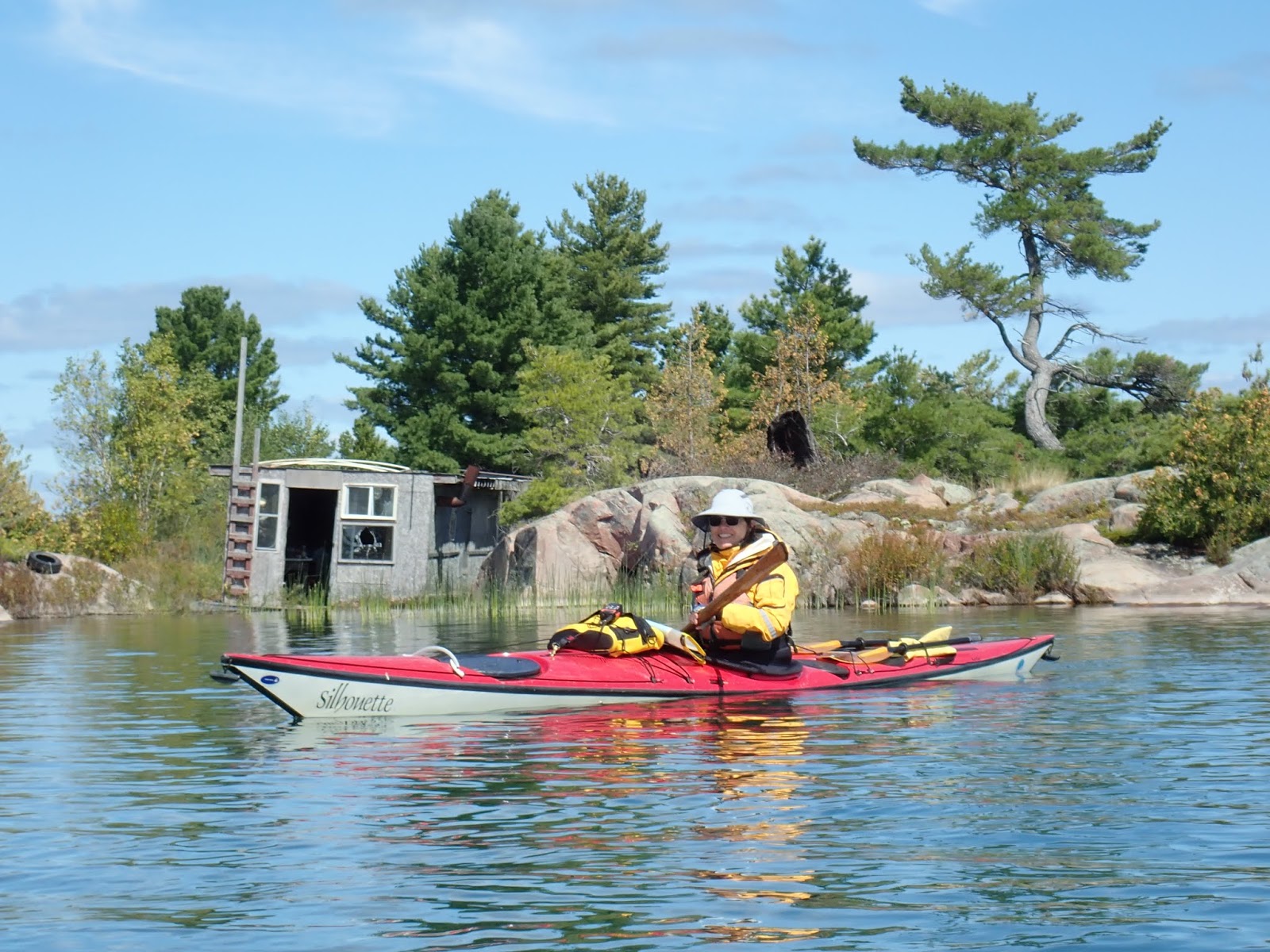
But enough about that. In addition to pooping, we also moved camp on Monday. Packed everything up, slid our way down the hill with all our gear down to the boats, and went off in search of our next campsite. One thing was for sure about this trip, if we had a big move to make it was going to be windy. Another thing, the land of Phillip Edward Island and its environs is "crown land" - undeveloped land open to camping. We had a map with campsites marked, and we had a guide from a local canoe outfitter company listing campsites, but there really are no formally designated campsites - rather, the maps mark places that are known from experience to be good for camping, that is, they have places to land boats and some flat areas. However, there's no formal guide to the campsites and not all of them are amenable to groups with five tents, so setting off for the next campsite meant setting off exploring, hoping to find a suitable place to camp in the desired area.
 |
| Moving sites |
 |
| Exploring an abandoned structure |
 |
| Navigating |
 |
| Typical lunch stop while paddling |
 |
| Lunch stop |
 |
| "Limerick" campsite had some awesome views |
 |
| Kayak landing, "Limerick" campsite |
 |
| Moon rise |
 |
| Local resident after a meal - some kind of garter snake? |
Unfortunately, even though I had restored my GPS to working order by Monday it doesn't seem to have recorded track files so I can't show where we went, but we basically headed due east from Martin's Island, taking us across the bottom of Phillip Edward Island, scootched around the top of Hamilton Island, then went hunting for campsites in the triple bays of Bear Bay, Moose Bay and Deer Bay (fake news! despite theses names, we didn't see a single moose, bear or deer). After a choppy 5-ish miles (guesstimate) it was nice to get into the protected waters of the bays, where there were at least ten campsites marked. We knew that a big storm was supposed to be coming our way and so we wanted to find a campsite that met Tom's requirements (big, open flat rock - typical Georgian Bay), met others' requirements (set back from the open water to provide shelter from the storm, some trees for wind break, hanging food, and privacy for the aforementioned pooping), and was big enough to hold all of us comfortably. We quickly found that one of the canoe outfitter's marked sites met these needs, but still spent a bunch of time examining other sites before returning to the site on Crume Island the outfitter had labelled "Limerick". Clearly this was a well used site. You can tell this in Georgian Bay by the rock circles. Without enough soil to hold tent stakes, you instead secure your tent by tying it to big rocks. If you get to a site and it has circles of big rocks, it means someone has pitched tents there before. This site even had graffiti from 1971. It met all of our needs and more. It was a really good site. We made camp.
 |
| Unpacking the kayaks at campsite #2 |
 |
| My tent at "Limerick" campsite on Crume Island - note the rocks |
 |
| We did have a chance to make a campfire at Limerick |
 |
Have I mentioned the views?
|
 |
| Alfred and Mary were here ... in 1971! |
 |
| Paddling past a "skerry" |
 |
| This entry covers day paddling in "The Foxes" around the first campsite and the move to the 2nd campsite. |


No comments:
Post a Comment