Showing posts with label virginia. Show all posts

Thursday, June 25, 2026

CPA Belle Isle Camping Trip

 I haven't been on a CPA multi-day trip in a while. There aren't that many trips anymore, and they always seem to fall at times when I'm already committed. Well, I finally made it to a trip. Ralph and Sophie planned at trip which involved three nights camping at Belle Isle State Park on the Rappahannock River in Virginia, then another three nights about twenty miles up the Rappahannock at Naylor's Beach Campground. My plan was to join them for the weekday part at Belle Isle, but I would be heading home when they moved to Naylor's

Tuesday
The sites at Belle Isle have electricity, and believe me, I took full advantage. I have a brand new cooler-sized car refrigerator which I was able to plug in it the campsite. As it happened, the freezer at the camp store was broken and so people who were relying on coolers to keep their perishables cold had to leave the campground to replenish their ice supply - but no matter to me, I had a fridge! I also brought a string of Christmas lights to illuminate my campsite in the evening, an electric fan for my tent, and a folding electric kettle, which made breakfasts a snap. And since we're on the subject of camp amenities, I brought along a tri-fold mattress to sleep on. This is basically a three inch thick twin-sized mattress which folds in thirds. It's definitely not something you bring if you're at all squeezed for space (it's maybe 30 x 30 x 9" when folded), but I had room in the car for it, so I brought it. It was easy to set up (just unfold it) and mighty comfy to sleep on. More and more of my camping trips seem to lean towards "glamping" - I guess that's what happens as you get older.

My awesome little fridge (stinky neoprene boots for scale)

Campsite illuminated at night

Folding kettle

On the first day we all arrived at different times, so there was no group paddle. Ralph had, however, provided suggestions for local paddles. After taking a call at the launch about an upcoming gig (playing at Grateful Dead Night at the Bowie Baysox!), I explored the local creek and poked out into the river a little bit, paddling a little under five miles in all. A couple of people had launched earlier and explored further - out into the river and up the adjacent Lancaster Creek, but I didn't feel like paddling that far.

En route to the park I had stopped for lunch at Chipotle, but I only ate half my burrito bowl. The leftovers, which I of course had stored in my adorbale mini-fridge, served as the core of my dinner.   

In the evening some of us gathered around a campfire at Sophie and Jessica's campsite. Yes, in June in Virginia it was cool enough in the evening to have a campfire. It was really pretty perfect weather. It was at the campfire that I first met Peter, who turned out to be a memorable dude.

The morning of the second day I ran into Peter in the bathhouse. I wasn't sure it was him since I had only seen him in the dark, but also I may have had trouble recognizing him since I was distracted by the fact that he was naked from the waist down. I guess he hadn't counted on the possibility of someone else walking into the bathhouse while he was in there (or he didn't care) but there he was brushing his teeth at the sink, dressed in a blue t-shirt, bright yellow Crocs, and nothing else. If you put a sailor hat on him he would have been a dead ringer for Donald Duck. To Peter's credit, once I arrived he grabbed his pants and disappeared into a stall to get dressed. 

Welcome to the campground bathhouse!

Wednesday
We all met bright and early at Windmill Point on Fleet's Island. This is a really nice, recently developed launch. According to Ralph, until recently it was basically a dirt road which ended at the water, but the county has developed it as a recreational facility with a sandy swimming beach (which also serves as the car-top launch), lovely bathroom, and plentiful parking. Sweet.

One of the paddlers in the group discovered that she had left her PFD and skirt back in camp, which was about 40 minutes away. Ralph was ready to bend the rules and let her paddle without a PFD, which is mind-blowing if you are familiar with the safety-obsessed culture of CPA; however, another member of the group saved the day by running home (just ten minutes away) to grab her a PFD, which turned out to be one of those big orange Type II's you see on ferry boats - an appropriate paddler "cone of shame".

Oh, and Donald Duck showed up, wearing a keffiyeh wrapped around his head and face for sun protection. Now, go back a couple of years, say, to October 6th, 2023, and I really wouldn't have batted an eye over someone showing up with Arab headgear for a paddle - I mean, heck, people in the Middle East do know a thing or two about covering up to be sun-safe. However, in the years since the Hamas attack on Israel on October 7th, 2023, the keffiyeh has been transformed into a pro-Palestinian (ok) / anti-Israel (bad) / pro-Hamas (pretty damn bad) and even antisemitic (really, really bad) political symbol. College kids who couldn't find Ramallah on a map drape themselves in keffiyehs to symbolize their support for the destruction of the Jewish homeland and its people. Now, in Donald Duck's defense, his keffiyeh was red and white, which is usually Jordanian rather than the black and white typically associated with Palestinians, and a look at his Facebook page shows no antizionist content whatsoever. In addition, he seems to be involved in re-enactments of 19th century European battles from the era when soldiers wore giant hats and plumes into battle, so I think for him wearing it was mostly a dress-up thing. But it bugged me to look at it every day. And the red keffiyeh clashed with his yellow Crocs. But at least he was wearing pants. 

Anyway, Fleet's Island (named after 17th century English settler Henry Fleet) sits just at the mouth of the Rappahannock. Our paddle took us up the outside of the island, which meant that we were paddling in the Chesapeake Bay. Windmill Point is at the bottom of the island and we paddled all the way around the top, where we took a lunch break at Cedars Beach. We could have continued and circumnavigated the island, but those who have done it said the inside of the island is hot and boring, so we made our way through some marshland at the top of the island and scooched our kayaks back onto the Rappahannock via a shallow cut which wasn't quite deep enough to float the kayaks. I was close enough to being afloat to be able to slide my kayak along by pushing my hands along the bottom; some of the group, that is, those endowed with heavier butts, had to get out of their boats to make it through. Once back on the river we retraced our steps to the launch, at which point some of us (including me) got off the water, while others got some extra mileage in exploring a little bit beyond the launch before heading in. I paddled about 8-9 miles.

Paddling around Fleet's Island


Scooching across from the marsh into the river

Lunch break (check out keffiyeh boy ibn the middle)

After the paddle there was a plan for the group to go out for an early dinner (4:30ish!) at a restaurant in White Stone called The Sand Piper. Based on a combination of health and religious-driven dietary restrictions, I don't do well at seafood restaurants, as I don't eat shellfish, beef, or pork. Typically, such restaurants have one or two dishes with either fin fish or chicken, but such dishes usually tend to be pretty sad. I mean, virtually no one goes to a seafood restaurant to eat chicken, so whatever chicken breast they have is some antique, freezer-burned thing they'll defrost for the rare non-seafood eater who comes in. I decided to skip the group dinner and head back to camp, where I enjoyed the home-made low sodium minestrone and fresh roll I had brought from home. There wasn't much hanging around that night, but that was OK - I read my book and had a beer at my campsite.

Sand Piper menu with all the things I can't eat crossed out

Thursday
Thursday's forecast called for high winds, so we headed for the relatively protected waters of the upper Great Wicomico River, launching from Cooper's Wharf. This isn't one of Ralph's favorite paddles, given the the Great Wicomico is entirely developed, that is, the shoreline is dotted with houses, but it made for a safe paddle on a blustery day. And blustery it was. We headed downriver first, with the wind at our backs. That meant we had to be careful, since the return trip was going to be more of a slog than the outbound leg.

The trip was uneventful We paddled down as far as the big Rt. 200 bridge over the river. Sophie and Jessica continued on to try and find a launch they thought existed somewhere near the bridge (they found it!) while the rest of us turned back. The paddle back wasn't as bad as I thought it might be -  keeping to the river's south shore gave us some protection from the south-westerly wind, though we did hit spots where we got blown about by the gusts.

Taking aa break from the wind in a cove

Given that the shoreline was all private land, our only choice for a lunch break was to paddle back to our launch point and take a break there. After lunch a few of us explored in the opposite, up-river direction for an hour or so. This section of the river turned out to be more remote and pretty, but it didn't go on very far. I paddled a total of 11 miles.

My plan had been to camp Thursday night at Belle Isle and to head home in the morning when the group broke camp. A forecast of rain overnight made me change my plans, as there was really no point in camping in the rain just to go home the next morning with wet gear, so I broke camp and headed home Thursday night.

The group had a scheduled potluck Thursday night, and I felt very antisocial when I stopped by to say goodbye. The previous night I had blown off dinner at the seafood shack, and here I was snubbing the potluck. Oh, well.

It had been a long time since I'd done a trip like this and it felt good to get out paddling in pretty places three days in a row, and to sleep in a tent on some lovely, not to hot or humid nights.

Also note that Thursday was the 27th anniversary of the day I bought my first kayak!


Monday, October 31, 2022

Fountainhead Foliage

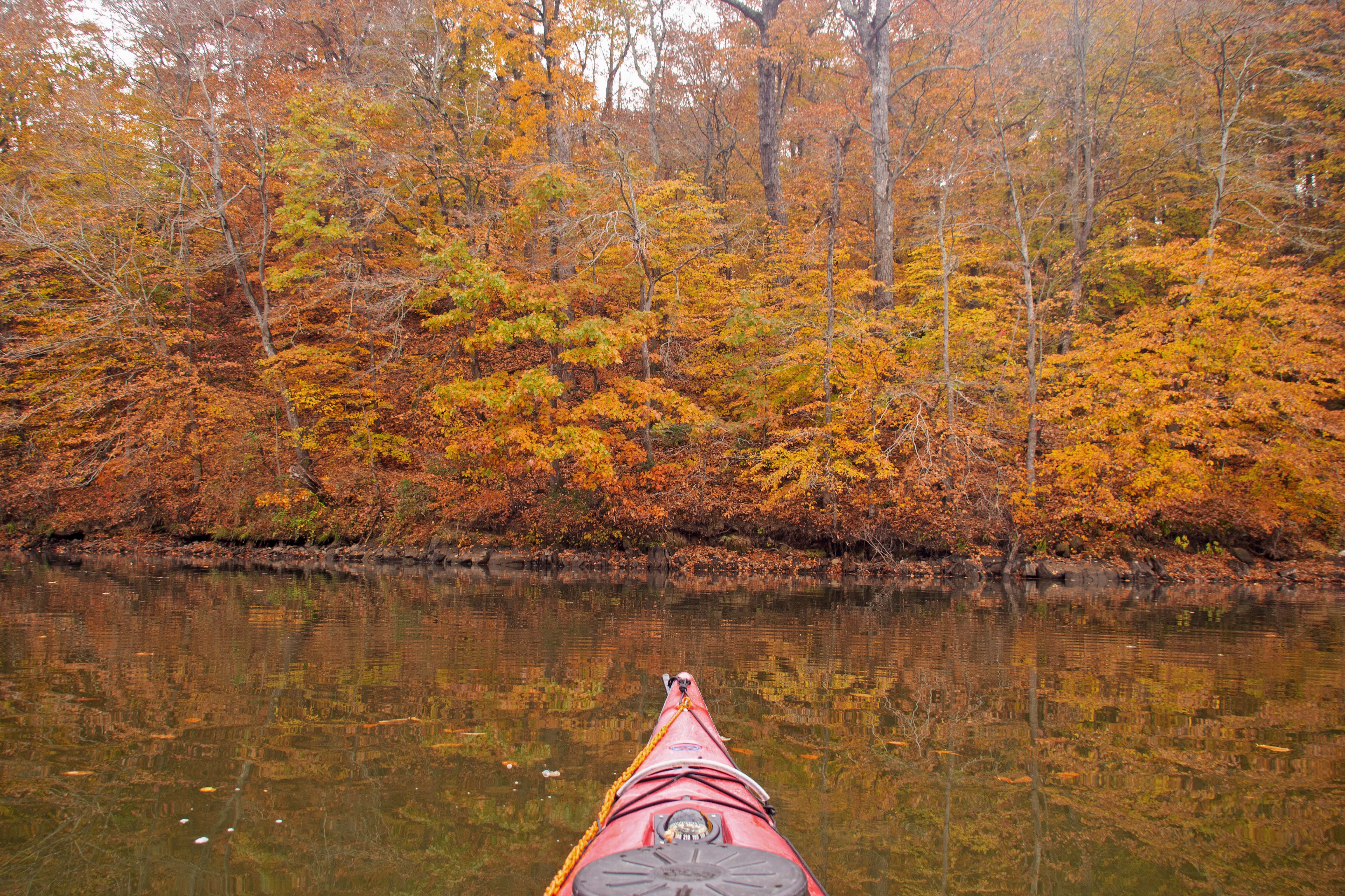
I am a glutton for fall foliage. This year I've already sought peak foliage hiking in Shenandoah National Park and Sky Meadows State Park, not to mention the not insignificant foliage pleasures of driving to rehearsal through Rock Creek Park in DC and biking the W&OD Trail through Bluemont Park. But still I wanted more. Part of my foliage addiction is always trying to re-capture peak foliage experiences of the past. Fountainhead is always a sweet spot for foliage paddling, and in 2016 I hit it just right and experienced some truly sublime beauty on the water. I was pretty sure that today, a cloudy day slightly past peak, wasn't going to equal that day, but I decided to give it a try.

I hit the water about 9:10 AM. The reservoir level is very low; for those familiar with the boat launch, the water line is about a a foot short of even touching the rubber mats at the ramp (these mats usually extend into the water). I launched and got in about fifteen minutes of paddling before it started raining. The rain, which wasn't supposed to have arrived until evening time, got harder and harder. I was wearing a Hydroskin top, which would have kept me reasonably warm even when wet, but rather than being wet and kind of miserable I decided to head back and grab my "splash jacket" (rain top) from the car. So I paddled back. Does it even need to be said that by the time I got back it had stopped raining and not a single drop more fell from the sky after I put on the splash top?

I had the place almost to myself. Two fishing boats, a couple of other kayakers, and a whole lot of quiet. Not much wildlife, though. I saw one eagle and a handful of great blue herons, but that was it. The foliage was, as expected, a little past peak, but still quite beautiful. Interestingly, the colors looked more vivid while it was cloudy. Late in my trip the sun started to peek out from the clouds and the brighter light washed out the colors.

I did try to take a break at my turnaround point. With the water level so low, the normal shoreline is unreachable and what's exposed is a bunch of mudflats. I tried to get out of my kayak and immediately sank calf deep into mud. Fortunately, I was still straddling the kayak and so I just sat back down into the boat before the mud pulled my shoes off. I then had some coffee and a granola bar while floating around the cove with my feet hanging out of the kayak, until I finally spotted a rocky area which was solid enough to support me. It was nice to stand up and take a relief break.

When I got back there was absolutely no one around at the normally busy boat launch. As is my usual practice, I loaded the boat then used the yucky bathroom you pass on the way out to change clothes. The park was so deserted that I was tempted to treat the bathroom as a locker room and change clothes in the middle of the bathroom, but I figured that with my luck someone would walk in just when I had all my clothes off, so I changed in the cramped stall.

A stop along the way. Colors pumped up in Photoshop? Maybe. ðŸ™„
 
View of the reservoir. Colors pumped up in Photoshop? Maybe. ðŸ™„


Sky Meadows with Steve

All the hikes I can remember ever having done at Sky Meadows State Park in Virginia start with a walk through the cow pasture (carefully tiptoeing around the cow patties) and then up onto the Appalachian Trail. It turns out there are some other nice hikes in the park, including a loop I hiked with my friend Steve. We were pointed to this hike by Steve's twenty year old hiking guide, which was a little inaccurate in the details (it appears they've reworked one trail junction since the book was written), but which generally steered us right. The hike took us past some magnificent views with valleys filled with pastures and hillsides alive with fall color. Yes, we eventually had to traverse the cow pasture, but coming at it from the other direction you realize that there's a splendid view from the top of it.

The day started out cloudy and rainy, and we delayed our departure hoping that the rain would move out. In fact it did, and the weather behind it was better than had been forecast, with blue skies by the end of the afternoon. A really nice hike with near-peak foliage.

View from George's Overlook

In the woods

View from the top of the cow pasture


Wednesday, September 1, 2021

A Magical Day on Belmont Bay

Belmont Bay has been one of my favorite places to paddle since way back at the beginning of my kayaking explorations. The setting is beautiful, the bird life is outstanding, and it's a no muss, no fuss launch - you can pull right up to the launch beach to unload. The launch is car-top only, so you're not dodging power boats Frogger style. 

The launch at Mason Neck State Park

In the days before blogs I kept notes on my paddling in a written journal and my first entry for paddling at Mason Neck was from my second visit there, on 7/25/1999. The entry mentioned, which I had forgotten, that Mason Neck was the first place I launched my very first kayak. It's a special place for me. I think it's a special place for a lot of people.

My choice of Mason Neck for this particular outing was to do maintenance on a geocache I had placed on little Conrad Island, across the bay near the powerboat channel. I'm not really doing much with geocaching anymore, and this is the last active geocache I maintain, but it's one of the few "hydro" caches - ones which can be reached only by boat in the area. People like it, so I like to keep it active. The water was glassy as I paddled across to the island, which as usual, was a mess of bird refuse - half-eaten fish, guano and feathers - as well as poison ivy. As I paddled across I spotted two bald eagles, one in mature plumage, and one still in immature brown plumage, perched on a branch sticking out of the water. You rarely see eagles down at the water line, so this was kind of special. The immature eagle flew off, but i got a picture of the mature one. Once at the island, I replaced the log (paper people are supposed to sign to prove that they've found the cache) then headed out towards the river.

Eagle by the water near Conrad Island

Mason Neck is always a good place to see eagles. It's rare that you visit there without seeing one, but some days are just ridiculous. As I paddled along I saw eagle after eagle after eagle, so many so that eventually I stopped counting. Eagles are rock stars within the bird world, but I shouldn't ignore their fellow Aves. As I made my way I also saw great blue herons, cormorants, ducks, geese, ospreys, and all those tiny wading birds that I can't identify. 

As I paddled along the western side of the Mason Neck peninsula I spotted another eagle at ground level, standing along the shoreline, fishing, I guess. As I turned to get a better look I inadvertently flushed two more eaglesI hadn't noticed, which took off from the bushes and flew away. The first eagle, though, remained on the beach. He seemed to be holding one wing down a little bit, but to tell you the truth I have no idea whether that was normal eagle posture or whether it indicated an injury. In any case, he didn't fly away. In fact, he stayed put and allowed me to approach. I got as close as I felt like getting, eventually stoppinga bit offshore because I didn't want to cross the line into harassing the wildlife. The eagle hopped from the beach to a branch, but generally stayed put. It stared at me. I stared at it. I snapped a million pictures. It felt like some sort of animistic spiritual experience, like maybe this eagle was a sign that the new year (the Jewish new year starts next week) was going to be a good one. Realistically, the thing's thoughts were probably along the lines of, "Big Creature approaching! Danger? Worth giving up food to get to safety?", but it felt like more. Eagles are really big, by the way and have powerful looking claws and beaks. If this thing had decided to defend itself and attack me I could have wound up in bad shape - all the more reason to "social distance" from it a bit. Eventually, mesmerized though I was by this majestic bird, I decided to back away and leave it in peace. I continued on my way and was still saying, "Wow! Wow! Wow!" to myself in my head over my eagle encounter when I stumbled across a field of lotus plants in full bloom. Yes, apparently there are lotus plants growing wild at Mason Neck and I was happily surprised to spot a bunch of gorgeous yellow flowers poking out of the water. I stopped again, this time to ogle the flowers. I've seen lotus blossoms at Kenilworth Gardens in DC, but it's different to be out on the water with them. Again, beautiful.  And of course, there were more eagles along the way - two in a tree here, one in a tree there. And herons. I half expected to round the point and find a leprechaun sunning himself on the beach,

Approaching the eagle

I really was this close

Into the lotus blossoms

Lotus blossoms

I had already been out on the water longer than I had planned and so once I got to the mouth of the bay I turned around and headed back. I didn't see my eagle friend on the way back - either he had flown off or I just missed him.

Two more eagles - most days, this would be the "money shot"

And another

And a fine looking heron

Once I got back I was walking up the hill to where I had parked my car when I noticed an odd fruit smooshed on the ground. Omigod! Paw paws! For years I've been hearing about paw paws, which grow wild in the mid-Atlantic. Paw paws have a storied history - native Americans enjoyed them, Lewis and Clark ate them on their journey, there are towns named "Paw Paw" in several states (mid-Atlantic cyclists will be familiar with the Paw Paw Tunnel on the C&O Canal tow path, located near the town of Paw Paw, WV), and there's even a kid's song about them. Paw paws supposedly taste tropical - sort of like banana, sort of like mango, with a custard-like texture. I've heard so much about these amazing wild fruits and every year I swear to try and find some - and every year I forget to do so. This year I had recently seen a post online about how paw paws are coming ripe, and as usual had promptly forgotten about it. But here they were - staring me right in the face. Actually, they were a little above my head out of my reach (where's Tall Tom when you need him?) so as I drove out I stopped the car under the paw paw tree and was able to reach some by standing on the door sill. So on top of an amazing eagle encounter and the beauty of wild lotus blossoms, I can now cross off the bucket list item of finding wild paw paws. As I write this, I realize that said paw paws are still sitting in my paddling bag, as of yet untasted. As soon as I wrap up this entry, I'm off to the kitchen to taste my paw paws! 

Back at the launch there were butterflies all about


Saturday, March 13, 2021

A Couple of Trips on the Occoquan

I have met Linda* exactly once in person, but for the second year running she has loaned me her Bull Run Marina launch pass over the winter. Bull Run Marina is this odd sort of arrangement - it's a public launch, but you have to pay an annual fee to use it. It's not staffed, so your annual fee gets you a parking pass and a key which works the padlock (after a fashion - the lock is finicky) to a gated entrance. Having the Bull Run key is probably the closest I'll ever come to the gated community lifestyle.

My usual kayaking crew hasn't been that active lately, so on one of the first warm days I headed down to the marina by myself. I always feel like something of a freak suiting up there in all my cold weather gear. Most of the ramp users are fishermen, who don't wear cold weather gear, and the few kayakers I've run into in the cold months either don't know or don't care about cold water safety. I've gotten some odd looks as I wrestle myself into my full dry suit, spray skirt and PFD.

My dry suit is almost, but not quite, impossible to get into solo. It zips across the back, which keeps the zipper out of the way while paddling, but in order to zip it you have to be able to reach behind your back and pull this hard to pull waterproof zipper across from one shoulder to the other. Over the years I've figured out a technique that works, attaching a string to the zipper, reducing the depth of the contortions required and giving myself a little more leverage. Only once have I run into real trouble, when the fabric of the shirt I was wearing underneath got caught in the zipper and I thought I was going to have to give up and drive somewhere to have someone free me from dry suit - but eventually I got the zipper unjammed. It's much easier with a friend to help!

Anyway, the marina sits right where the Occoquan Reservoir, which is never more than about 1/4 mile wide, narrows down further into Bull Run, so if you head to the right when launching it's very protected paddling in narrow, often shallow water. Given the cold water conditions, that's where I went.

On my first outing I was totally freaking myself out about how I was out there by myself in cold (40-ish degree) water. It was a little breezy - nothing significant, but enough to make me worry with every little wind riffle on the water. I kept very close to shore in case of capsize. Paddling close to shore carries its own risks of entanglement with plants, fishing lines, and so on, but it seemed the right thing to do.

The second trip was much more comfortable. For one thing, I was paddling the Tempest 165 rather than the 170 - paddling a sports car rather than a barge. Secondly, it wasn't my first time out, and thirdly, the water was warmer (50-ish) and therefore less dangerous, coupled with really nice air temps. 

Neither outing was particularly far (4.3 miles the first time, 5.5 the second) or fast (a hair over 3 MPH both times), but it was really nice to get out on the water again. Plus, the second trip did have an amazing wildlife highlight! As always, I saw great blue herons, kingfishers, geese, and ducks. The turtles were starting to show themselves as well. But on the way out, as I paddled I suddenly heard a big splash by the bank and saw a trail of bubbles left by something swimming away underwater - probably an otter or beaver. I made a note to check that area on the way back, and when I did, sure enough, I spotted a big beaver right about in the same spot. Not only that, it was a very mellow beaver who did not mind paparazzi. Expecting just a fleeting glimpse before he took off, I grabbed my camera as deftly as I could, trying to be slow and smooth so as not to spook the animal, but also fast enough to get a picture before the animal inevitably disappeared, and squeezed off a couple of "see that smudge in the lower right? It's a beaver!" photos. Since it turned out it wasn't going anywhere, I then crept a little closer to get a better look/photo. And a little closer. And a little closer, snapping pix all the way. And, boy, this beaver was totally cool with it. I stopped at a point where I didn't want to get closer because I don't really like to get in the face of the wildlife, but take a look at the picture - shot with my little waterproof point and shoot and barely cropped - and you'll realize I was pretty close. The two of us sat and checked each other out for quite a while before he finally got sick of my ugly mug and swam away. It was a very, very cool experience, and I grinned ear to ear all the way back.


Back at the marina, the ramp was as crowded as I've ever seen it - which meant about six people milling around. This being the fishing boat crowd, of course no masks were in evidence, but we were outside and I didn't have to get near anyone else so it was OK.

Wildlife adventures close to home are awesome.


*Not her real name. 

Tuesday, July 7, 2020

A Hike to Raven Rocks

Quarantine can make you a little stir crazy. In particular, I knew that I’d be absolutely stuck at home for the next two days while we have a minor home improvement job done, so I felt a strong urge to get out of my usual haunts and go somewhere different today. The problem is it was a really hot and sticky day. I didn’t feel like roasting myself out on the water, and I didn’t necessarily want to commit to a long bike ride. For a while I’ve been itching to go for a hike – an itch that only intensified recently when I came across the Japanese concept of “forest bathing”, which is sort of mindfully immersing yourself in the woods. Some friends of mine were performing at B Chord Brewery out in Bluemont (about 15 miles past Leesburg), so I decided to head out that way, figuring that if the timing worked out I would stop by and see their performance after my hike. I chose the Raven Rocks hike on the Appalachian Trail: about 5.5 miles round trip of very steep, rocky terrain, but with a reward of an excellent view at the destination.

Reading about the hike online, the first thing I noted was that there was limited parking at the trailhead but plentiful parking at a lot less than ¼ mile up the road. Don’t park along the roadside, the writeup warned, or you’ll be towed. I knew I had reached the trailhead when I saw a small parking lot and a whole bunch of signs saying Don’t Park Here or You’ll Be Towed. Well, I could see one such sign – there were cars parked in front of the rest of them. I guess people aren’t willing to add a short walk to their hike? I didn’t like having to worry about my car all day and so parked at the spacious lot up the road and walked back along the shoulder to the trailhead.

The hike is part of what’s known as the “rollercoaster” section of the AT – continuous ups and downs, ups and downs. This hike was a series of steep ascents and descents: a descent from 1,100 to 1,000 feet, back up to 1,100 then down to 800, then back up to 1,200 to get to the summit. According to the listing for this hike on HikingUpward the total elevation gain for the hike is 1,530 ft. For the sake of comparison, the Empire State Building, including spire and antenna, is 1,454 ft tall. So this hike was like walking to the top of the Empire State Building, climbing the spire and antenna like King Kong, then walking up another eight flights of stairs in 90 degree, humid weather on very rocky terrain.

Stupidly rocky terrain (note trail blaze on the tree dead center)


Crossing the state line

My kayaking friend Randi has a bumpersticker that reads, “My dream vacation is your worst nightmare”, and in a similar vein, I’m sure some readers of the last sentence thought, as they were reading it, “this is what you do for fun?” Actually it was quite a nice hike. Yes, I was sweating like a pig, and yes, I was concerned enough about the rigor of doing steep and rugged climbs in the heat that I was monitoring my pulse throughout. But the forest was shady and beautiful, and when I crossed the state line into West Virginia and made the final climb to the summit I was rewarded with a stunning view of the valley below. I settled into a quiet spot to take a break and have a snack. I soon noticed two small lizards moving about nearby. Eastern fence lizards, it turns out (I looked it up later). They weren’t skittish and let me get fairly close to take pictures. Well, let me tell you, nothing beats sitting on a rock ledge looking out over a beautiful view on a sunny day in the company of two adorable little lizards.

Vista at the top
Lizards!
Striking a pose
Can one have too many lizard pix? I think not.

The hike back seemed shorter and maybe a little cooler. At the top I had checked my water supply and realized I had consumed maybe a third of my water and so drank more generously on the way down. A little too generously, since I wound up running out of water before the end – but only ½ hour or so before I reached the trailhead, so not a big problem. As on the way up, I passed by a fairly steady stream of hikers going in the other direction. Everyone was careful about giving each other lots of “social distancing” space. My favorite was a young backpacker who was blasting Jerry Garcia’s “They Love Each Other” as he hiked. I guess a little Jerry helps you get through the day.

When I reached the trailhead I used the remote start feature on my car so by the time I reached the car it was cooled off inside. Getting into the car was a machayah (a Yiddish word meaning something refreshing – literally, something that revives the life in you).

I changed into a fresh shirt and headed over to B Chord, but when I got there I could see that the show was already over so I turned around and instead went to Dirt Farm Brewing, about 2 miles away. I had heard Dirt Farm has a beautiful setting and indeed it’s true – they’re up on a hillside and you can sit out on their patio (at socially distanced picnic tables) and enjoy a great panorama of the valley below. I ordered their Bumpah IPA, a glass of water, and indulged in a bag of potato chips because I was really hungry (I had brought only snacks – not lunch) – but I limited myself to only half the bag, because, y’know, salt and fat. The beer reminded me of Sweetwater 420, which is brewed to have a smell and taste reminiscent of the skunkiness of marijuana (“420” is some sort of reference to marijuana – look it up). I’m not a fan of the skunky experience and so 420 has never been my favorite beer – I also associate it with my stressful year running the DARPA TRAPS project, since it’s the beer available in the Delta Airlines lounge at Atlanta airport where I’d always change planes, but that’s a story for another time.

The view from the Dirt Farm patio - no hiking required

Skunky beer aside, it was still pleasant to have a cold beer in such a scenic setting after a strenuous hike. Since I was by myself I didn’t linger long and soon headed home. The combination of the heat, exertion, and alcohol delivered a knockout punch and as soon as I got home I crawled into bed and passed out for an hour or so, waking to find the electricity in my house in a weird, browned out state where some things worked while others didn’t, but that as well is a story for another time.


Wednesday, November 18, 2015

Here, There and Everywhere

The low part of the trip came Friday morning. Bleary-eyed, I left my room, went down to breakfast, drank about twice as much coffee as usual (which is saying something) and then went to return to my room only to realize that I had no idea what my room number was. I actually had to go to the front desk and ask them to tell me my room number. I had gotten in late the previous night after a delayed flight back out of Atlanta, and had gotten to bed around 3 AM. The previous night I hadn't slept well because of job stress, and the day before that had been one of those 12+ hour days I tend to have when I travel. And here I was at the crack of, well, maybe it was 7 AM or so trying to function. Worse yet, I had driven from Richmond (where I had pre-positioned my car and kayak gear before flying to Mississippi) to Williamsburg to be near the kayak group, and they had chosen to paddle closer back towards Richmond to accommodate me since they assumed I was staying in Richmond. So, grabbing yet another cup of coffee I dragged myself out to the car for the 25 minute drive to Eagle's Landing.

Everyone is ready to launch - except my boat is still on the car

Well, no matter. I got to Eagle's Landing only 15 minutes late. The group was still milling about getting ready to leave and so I only held things up a little bit. We paddled upriver through the narrow, upper Chickahominy River, up to the Rt. 155 bridge. There was a lot of water in the river and so we were able to make it up past the bridge into some abandoned, flooded old gravel pits. The pits offered some nice shoreline for a lunch break.

Lunch Break at the pits

After lunch some folks headed straight back. I, feeling surprisingly energetic, joined the sub-group which chose to explore the pits - which are essentially interconnected small lakes - for a bit. Pastor Pete, who used to live in Richmond and paddle this area, thought there was another passage through the pits  to the "Old Chickhominy" which would have allowed us to do a loop to get back to Eagle's, but after several dead ends we gave up and headed back the way we came.

Friday's route is upper left, Saturday's lower right

I had marked waypoints at the little cut-throughs between pits so we could find our way back. I served as navigator on the way back, head down staring at my GPS to guide us waypoint-by-waypoint back to the river. Meanwhile, Jim A. was way out in front as he used his animal-like sense of the lay of the land to naturally find his way back. Like most people I can get turned around on the water - a lot of shoreline looks the same! - but Jim is one of those people who somehow through instinct always knows where he is.

I mentioned earlier that the Chick had a lot of water in it. That was great for extending our paddle to the upper reaches of the river, but it also made for some tricky flows  to deal with as we made our way through the twists and turns of the river. On the way up Linda D. got pinned by the flow against a "strainer" - a downed tree in the river, and on the way back she got taken by surprise by an overhanging branch and capsized. That left us having to do a rescue in a rapidly flowing river - not an easy task. It's funny - the river was no more than 50 ft. across at that point. No one was ever far from shore and no one was in real danger. But still, maneuvering kayak and paddler to a spot where they could be safely reunited was tough.

Suzanne and Pastor Pete rescue Linda

The rest of the trip back was fortunately uneventful and when we got back everyone headed back to the campsite. I hadn't brought my camping gear with me - the whole notion of rolling straight from a business trip into camping seemed like a bridge too far - and so continued to stay at the hotel. I headed back there to clean up. had planned to stop by the campground to catch Paula's presentation on VHF radio usage (as well as Ron's inexplicable group Erev Shabbat service) but on the drive to the hotel my tiredness finally hit me and I chose to nap. Or rather, a nap chose me.

I woke up in time to go to dinner. That was its own little drama, which I won't bore you with. Bottom line, Rob, Sophie, Suzanne, Madeline and I wound up at Two Forks Diner, where some other folks were already  eating. There wasn't much on the menu which wasn't shellfish, pork, or mixed meat/dairy. For me the choice came down to a burger or spaghetti and meatballs. I ordered the latter, which included what may have been meatballs and may have been leftover Civil War cannon balls - it was hard to tell. Well, the place did have a nice, friendly down-home southern diner charm, even if their choice of wines was, "red or white".

After dinner the group headed back to the campground. I returned to the hotel and went straight to bed.

Saturday morning I met the group at the campground as folks were finishing breakfast and getting ready to hit the water. A group of us had decided to paddle straight from the campground's boat ramp, avoiding having to transit to the put-in. This put us on a lower, somewhat more open section of the Chickahominy River. We headed upriver into the wind, which made for a tiring paddle, then did a loop through some marshes - into one creek and out another. We launched at 9:30 AM and by noontime everyone was ready for a break, but in the marshy areas it was impssible to find a landing spot with solid ground and room for 11. Finally, back out on the Chick we found a little beach where we were all able to stop for a lunch break. For the second day in a row I had brought a can of tuna but no utensil with which to eat it. It was one of those cans of spicy Thai seasoned tuna - tasty, but quite oily and therefore messy. But I was undaunted. I stuck a finger into empty wrapper from a granola bar and used it as a scoop to eat the tuna - pretty sloppy going, but well within the bounds of kayak etiquette. After lunch it was a fairly short paddle back - a 15-16 mile day.

November sunshine - Saturday
A highlight of the Chickahominy trip is always the Saturday night potluck. As usual, it was a varied and delicious feast - roast meats, turkey chili, salads, stews, veggies, and potatoes from Ron the potato man. Saturday night was also the only time I got to see the whole group of roughly two dozen, since people were doing different paddles on different days. After the pot luck we went to the adjacent site where the campfire was burning. People were astounded that I was going to drive home that night - until they realized that, though it was dark, it was only 6:45 PM, easily enough time to do a 2 1/2 hour drive and still get home at a reasonable hour. As it happened, while Tall Tom took off at about that time I wound up hanging around until 8 or so - and still got home at a reasonable hour.

And so there you have it - my take on how to visit three cities in two states, do two kayak trips, and most importantly, go cold weather camping without ever sleeping outside, all in 5 days' time.

OK, this is nerdy, even by kayaker standards


Thursday, October 15, 2015

Return to the Crooked Road

I was really taken by the scene in Floyd, VA when I briefly stopped here last Spring and I've wanted ever since to return for a deeper visit. I decided to plan a trip for Columbus Day weekend figuring it would be about perfect timing - cool weather and foliage - for Valerie's annual camping trip and would as well as a chance to expose my kayaking friends to this cool music scene.

Planning for the weekend got off to something of a rocky start. As is so often the case, Suzanne and I exchanged some testy email. Valerie dropped out because of back problems. Only a few kayak friends were available to come. Suzanne dropped out because her mom was sick - though she dropped back in soon thereafter. Even the people who were on board from the beginning ran into travel hiccups: Susan and Whit came down with their shiny new camping trailer but experienced some hiccups along the way - initial mechanical issues with the trailer (fixed by returning to the dealer), GPS leading them the wrong way, then they had trouble turning around because of the trailer, setting up in the wrong campsite, and so on. Suzanne and Manuel carpooled and wound up hitting terrible traffic. They were about an hour behind me at one point (I was in Harrisonburg, they were at the I66/I81 interchange) but they hit big backups on I81. GPS led them the wrong way as well (doesn't anyone check maps anymore?) and they would up not getting to the campground until three or more hours after I did. Suzanne was on the road for something like 11 hours!! I was more than a little concerned about their frame of mind, particularly given that Suzanne had been on the fence about participating at all.

Despite all the travel hassles the evening in Floyd was quite awesome. Susan, Whit and I met up at the campground and had some snacks and watched deer and wild turkeys roam the campground while we waited for Suzanne and Manuel to arrive. When it started to get towards dinner time we texted Suzanne - and found out how delayed they had gotten. Ultimately, the three of us decided to head to town after buttoning up our campsites for the expected rain. We ate Mexican food in Floyd (good veggie selections!) then roamed the Main Street a little bit, checking out the impromptu bluegrass jam sessions out on the street before finally heading into the Floyd Country Store. The first act, the Davis & Elkins Gospel ensemble, was just finishing up (it seems the first set is always gospel). The second set transitioned to dance music and as expected, flat-foot pandemonium broke loose. It's a whole lot of fun to watch these folks dance - wish I could join in! I grinned from ear to ear all evening.
Friday Night Jamboree in Floyd
Floyd is a loose and relaxed scene. We watched for a while, got ice cream and then hung out outside for a bit. Susan and Whit went for a walk. Suzanne and Manuel showed up but then went to the Mexican place to get dinner. I wandered in and out. Mid-evening the forecast rain rolled in, ending the impromptu jams - at least for the most part. While we were sitting out front of the Country Store finishing our ice cream a guy invited us in to the barbershop next door, where it turns out some of the local jammers had retreated to get out of the weather. Hangin' with a bunch of locals pickin' bluegrass in the Floyd barbershop, my friends, was a very cool experience. Susan sat down in the barber's chair and I parked myself in what I later realized was the chair for the big hair dryer - I got teased a little bit for that in a friendly way by the locals, given my lack of hair. We sat there listening to this group until 9 PM, at which point we went back next door to the Country Store to catch the last set. It turns out, not surprisingly, Floyd is not a late night scene and the place began to empty out, which allowed us to move up and get a great view of the dancing, which got more intense as the night went on. Flat-foot appears to be a mountain evolution of some kind of Scottish or English country dance. Like "Riverdance" it's all legs and no arms. Unlike Riverdance it's not a synchronized line dance - it's people doing this crazy clogging/tap kind of dance all individually. It's Appalachian St. Vitus' Dance. It's wild.
Pickin' in the barber shop

We finally got a chance to talk with Suzanne and Manuel, who had been sitting a few rows back. They were understandably exhausted and frazzled. We hung out at the Country Store until after 10 PM, then headed back to the campground to turn in.

Saturday dawned cold, rainy and foggy, which led to a slow start. I didn't roll out of my sleeping bag until 7:30. This is late for me anytime, and certainly for camping. I figured everyone else would be awake and well into breakfast, but it turned out that the grey, rainy weather had put all of us into a lazy frame of mind. One good thing was I had put up my pop-up shelter over the picnic table Friday afternoon which gave us a dry place to make coffee and breakfast Saturday morning. At around 11 Susan Whit and I headed over to historic Mabry Mill; Suzanne and Manuel were at that point still only slowly moving towards getting ready. The mill is an early 20th century water-powered saw and corn mill (the ground corn being used as much for moonshine as for cooking!). Very pretty setting. The place was surprisingly crowded - I guess lots of people had planned a Columbus Day foliage get-away, and like us, were looking for a rainy day activity. The only challenge with going to the mill was fog - the whole path along the Blue Ridge Parkway was pretty socked in with fog which made the drive a little nerve-wracking. Whit was driving, and fortunately he handled it well.
 
Mabry Mill
After we finished touring the mill we headed back (through more fog) into town. We had arranged to meet Suzanne and Manuel at the Country Store for the Americana Afternoon music at 1 PM, but ran into them at the farmer's market across the street, where we all had crepes for lunch. The farmer's market is held in a covered pavilion, which afford us shelter from the continuing rain. Floyd is an interesting combination of redneck Virginia and upscale hippie-dippie. The two cultures seem to coexist surprisingly well (except maybe when it comes to politics). The farmer's market has crepes and kombucha and organic teas and is frequented by a pretty granola looking crowd. The Country Store crowd is predominantly small town America, guys in plaid shirts, wrangler jeans and cowboy boots. But both types show up in both places. Music unifies all, I guess.

The Americana Afternoon is a much mellower scene than the Friday Night Jamboree - solo acoustic guitar folk singers rather than high energy bluegrass. Seating is at tables rather than just rows of seats. No dancing. We all got hot drinks and settled in at a table to watch the music (and, truth be told, to use the store's Country Wifi to catch up on email). We saw two different performers. I'm usually a music guy much more than a lyrics guy but here it was a split decision. Both performers were good. Both had good voices. I liked the first guy's style and sound much better, but his lyrics were a little forced. I think the second guy was the better songwriter, but as I said, I didn't like his musical performance as much. He was a young guy but he sang with a very raspy voice - it sounded like he was working to sound old and world-weary.

The music finished up at around 3 PM. We decided we'd go back to the campground to relax for a bit. It was still drizzly and it just seemed like a good afternoon to crawl into the tents for a bit. Susan, Whit and I made a stop on our way back to the car at the completely incongruous Floyd Computer Museum. Someone has rented a storefront and filled it with old desktop computers (the case from an Apple I, an Exidy Sorcerer, TRS80's and Commodore 64's and the like). According to the kid working there the exhibited items are just a small fragment of the owner's computer collection. We suspect that the owner, one David Larsen, is an affluent local. The computer museum displays included copies of his old "Bug Book", a recipe book for building computer circuits from back in the days when computer hobbyists built their own computers. The Bug Book sounds vaguely familiar to me, and the display said that over the years he sold over a million copies of the various editions. Maybe that gave him enough money to finance his pet projects, like the computer museum and the private campground Whit and Susan stayed at Thursday night - which we suspect is owned by him as well. Anyway, it was back through the fog to the campground. I started this entry then took a little nap.

At a couple of times during the weekend we chatted with the guy in the next camp site, a solo traveler camping from his motorcycle. He was recently retired and had gotten himself the bike (and learned to ride) as a retirement present and now he's spending his time cruising around on his bike. I didn't envy him on the foggy, rainy days - having to either get on the bike and ride in the rain or stay put in his tiny backpacking tent. But the idea is cool.

Anyway, after we had all rested for a bit we headed back into town (through the thickest fog yet) and ate at an Italian restaurant Susan and Whit had eaten at on Thursday. It was quite good - far above what you might expect in small-town America. Then we headed over to the Wildwood Farms Garden Center and General Store for another musical performance. What, your local garden center doesn't have a stage area where they have bluegrass and old-time music concerts on Saturday nights? I guess, then, that you don't live in Floyd.

We got there a half hour into the performance and the place was packed. We barely found parking. The woman who seated us had to go get more chairs to accommodate us. The band, Gravel Road, was a group of local teenagers ages 13-15. They were quite good. The girl who was their lead singer and mandolin player was this skinny little 13 year old, but she has a great voice and tremendous stage presence. She also had the energy, after performing as part of a clogging team in the morning and playing two sets, to get out on the dance floor and do some high energy dancing during the encore. Very impressive! Remember the name Addie Levy (Levy?!); she's going to be a bluegrass star some day,
Gravel Road at Wildwood Farm

When Gravel Road took a break the woman who had seated us, who it turns out is the sister of the store's owner, was the lead singer. She had a soulful, Loretta Lynn kind of voice. She was accompanied by two brothers, older gentlemen, one of whom played the guitar and the other mandolin. They were good, but the kids were better!

I've got to say that all in all Floyd is a friendly scene. No grumbling at the gawking tourists. People are very welcoming and seem genuinely happy that you've come to share in the music with them. Visiting this area is like finding some jungle tribe which had been untouched by Western civilization and modernity - it's like a little section of the past, not preserved in amber, but alive and well on its own terms.

At the end of the show we left the garden center and headed back to the campground. The weather was slowly starting to improve and it was less foggy at the lower elevations, though up on the the parkway was foggier than ever. We had all ridden into town together in Whit's SUV. When we got back to camp Suzanne and Manuel started to walk back to their campsite from where Whit had parked but it was so dark and foggy they couldn't find their way - they had to stop and wait for me (I was the only one who had had the foresight to bring a flashlight) because in they literally could not find their way back to their tents. I walked them to their site and then returned to mine to settle in for the night. The bad news is that the weather hadn't cleared out during the evening as forecast. The good news is that the cloud cover helped keep the temps warmer than forecast.
Scenic View of the Blu Ridge


Murphy's Law of Camping: The weather always improves on the last day. After a rainy, icky, weekend Sunday was a beautiful day. Blue skies and crisp, cool dry air. We all still got a fairly slow start, but eventually got our collective act together and went for a hike along a trail which runs right past the campground. The ranger had told us that parts of the trail were closed due to flooding, so we chose to hike just a short loop section. Great views! It was a nice way to punctuate what had been a very nice weekend. Then, it was off to the business of breaking camp and heading home. I meandered my way up I81, stopping in Staunton to browse the antique shops and then in Harrisonburg for a coffee at the Starbucks. Farther up I81 the GPS vectored me off of the highway to avoid a traffic tie-up and IU wound up on a secondary road through the towns of Woodstock, Maurertown and Tom's Brook, the last of which is barely a town at all. Cute little towns through which to drive - certainly more fun than looking at tail lights on the Interstate. Then the ride down I66, and home.

With Suzanne, Manuel and Whit

Sunday, September 20, 2015

Return to Laurel Hill

This season my bike riding has been focused -  on road riding: commuting on the W&OD, road riding with some local clubs and Meetups, and gravel roads out in Loudon. I've been focusing on my new "adventure" bike for long rides and the old beater for commuting. I haven't touched the mountain bike in the longest time, but I woke up today saying,

"I Want My MTB!"*

I decided to head to Laurel Hill. This is a nice set of mountain bike trails created as part of the reboot of the old Lorton Prison complex. I rode there once before, back in 2013, but really didn't even remember exactly where the place was or what the trail layout was. I spent a bunch of time last night and again this morning looking online for an official park map, but strangely there doesn't seem to be one (I finally found an old one online tonight - not on an official site site but embedded into the AllTrails.com com site).

After a little blundering around looking for where I parked last time I wound up parking at the Equestrian Center lot, which turned out to be a great spot to park since it sets at the intersection of a few trails.

I rstarted with the Pasture Trail (this was just the "Yellow Blazed Trail" to me at the time, since I didn't have any kind of map).  The trails at Laurel Hill aren't typical woodsy single track - they're mostly through fairly open meadow. Some of the trails have a deep, narrow gravel-filled groove and riding them is kind of like being a phonograph needle in the groove of a record.* It's weird riding and wobbling along in this rut, but you get used to it.

At the completion of my first loop I stopped to find my bearings and got into a conversation with a guy named Kevin, one of the few other people I ran into on the trails. Kevin is a young dad and mountain biking is his way of getting a little break from the stress of caring for two kids and a big dog. He was waiting for a text back from his wife (he checks in every 45 minutes!) before heading back onto the trails. It was nice to have spoken with him, since we kept running into each other as we each made our way through the park's loops.

I next rode the Dairy Barn Loop ... I don't think I made it onto the Apple Orchard, but again, with no map, I'm not 100% sure where I was. I rode the Workhouse Loop, which is currently interrupted by construction, then rode the Pasture Trail again.
Why Does it Have to Be Snakes?*
At this point I had pretty much exhausted the trails loops accessible from the Equestrian Center (except for the two very technical trails) so I rode out of the lot onto Furnace Road and cut over to the Cross County Trail. My intention was just to cruise on the CCT for a while, but a trailhead for the Giles Run Meadow Trail presented itself. Giles Run is more typical single-track, winding its curvy, undulating way through woods. I wasn't sure if Giles Run was a loop (it turns out it is) and so I did it out and back to a point - I estimate that I rode about half of the loop, so turning around was about the same mileage as completing the loop would have been. I bumped into Kevin on this trail too!

By the time I got back to the Cross County Trail I had been out a few hours so I headed back on the CCT and made for the parking lot, passing through the "barrel bridge" along the way. The barrel bridge is a brick and masonry arch bridge which was constructed by prisoners from the Lorton prison in the 1940's (they made the bricks too!). As everyone knows, this is the only brick and masonry arch bridge in Virginia.

The Barrel Bridge

Loaded the bike, and I was home by noon.


-------------------------------
*Denotes dated cultural reference

They call it "Toronno"

[Read about the first part of this trip here .] Americans know that Canadians talk funny. On the fifth day of our trip I started the day wit...