Sunday, May 31, 2015

A Most Nature-Filled Outing

The range of nature you can see from the urban Potomac is quite amazing.

Thursday night's PoG kayak outing was called off due to thunderstorms. I left my boat on the car when I got home figuring that, Friday being a day off for me, I'd spend some time on the river in the morning. I launched from Columbia Island at about 7 AM and headed upriver towards Fletcher's Cove. It was a pretty morning and needless to say, I soon spotted the "usual suspects" of nature - ducks (with cute ducklings!), great blue herons, geese and cormorants.
Swan on the Potomac

Roosevelt Island Deer
Things started to get even better when I spotted a single mute swan off of Roosevelt Island. I paddled over to get a closer look. The swan was not bothered by my presence and continued feeding. After spending some time enjoying its grace and power, I started back upstream and almost immediately spotted several deer feeding by the shoreline on Roosevelt Island. I got a pretty good look at them, too before they turned skittish and retreated. As I continued up the river a bald eagle swooped by overhead. I spotted more deer along the shore above Georgetown.
Georgetown Deer

I had hoped to land at Fletcher's cover for a coffee break but the tide was out, exposing squishy mud flats which I would have had to have crossed to get to solid ground. I decided to forgo landing and turned back downstream. I had paddled upstream using my wing paddle. Part of the reason for choosing it was to convince myself to sell it, since I make only very infrequent use of it, but somehow on this outing I really got into the swing of the stroke (wing paddles have a unique and different feel) and made good time going upriver. I was enjoying the wing enough that I decided not to switch back to my regular paddle for the return trip and instead continued with the wing to the very end.

Coffee Break at Roosevelt Island
On the trip back I once again saw deer off of Georgetown (probably the same ones I saw on the way up).  The highlight, though, was spotting a deer swimming from the Virginia shore to the southern tip of Roosevelt Island. Some rec boat paddlers happened to be on the scene as well, and we all watched the deer swim its way across then bound off onto the island. Cool!

Deer Swimming in the Potomac

The Swimming Deer Bounds Ashore

Glowing from the number and unusual nature of the morning's wildlife sightings, I picked up my paddle and made my way back to the marina. About 10 miles in all.

Sunday, May 24, 2015

Baby's First Group Ride

Today I participated in my first group cycling ride ever. Looking for something different than just riding the Arlington Loop by myself, I sought out a group ride through Potomac Pedalers and wound up riding the Arlington Loop with a bunch of other people.

Unfortunately, I'm a slow rider and so am limited to the slower organized rides. Such rides draw geezers and casual cyclists. I showed up  and - surprise! - it was mostly a bunch of alter kocker guys, mixed with a few casual riders on hybrid bikes. One guy immediately launched into warning us to be careful out on the trail for dogs and children because they do their best to jump in front of cyclists and cause accidents.

And there you have it: the cyclist mentality. There are two types of people in the world: cyclists, and people who are in the way of cyclists. Thank you for that piece of advice, Mr. Cyclist, and may I compliment you on how your tight cycling jersey highlights your enormous gut?

There were some nice people on the ride too, young and old. Most folks were kitted out in cycling gear. I was defiantly wearing a cotton t-shirt, though I was wearing bike shorts (not the skin-tight Spandex kind), shoes and gloves. I got to wondering - if I want to ride with other people, am I going to have to start dressing in the cyclist garb I hate just to fit in?

We did the loop clockwise, opposite the way I usually do it, with THREE rest stops - one where the W&OD meets the Custis trail, one at Spout Run, and a third at Gravely Point.

At the very end of the ride, I happened to be riding second, just behind the leader, or "point" person. As the group crossed Arlington Mill Dr. the leader stopped in the middle of the street to block traffic so the whole group could get across (cyclists have the right of way over everyone else and all traffic signals, because, well, because all cyclists are ubermentschen). I kept riding, heading back to our starting point at the Shirlington Library, about another three blocks. When I got there I turned around and saw ... no one. I really don't know what happened to the group. Some folks were going out to luch afterwards at Cap City Brewery. Perhaps the whole rest of the group stopped there. Or maybe they just split up and went back to their cars. Or were abducted by aliens. Well, my first ride went out with a whimper, but it was still fun. I'll do another. One of the riders on the trip mentioned a casual cyclists Meetup - I'll have to check that out too.


Saturday, May 16, 2015

Trip to Thomas Point - to Make a Point

Meetups will eventually be the death of traditional clubs like the Chesapeake Paddlers Association. I’ve said it before and it was amply demonstrated by this event. 

Some folks have been agitating for greater water access in Anne Arundel County. There are parks on the bay which, while publicly funded and officially "public", have traditionally been accessible only by those in the immediate neighborhood who have the key/combination to get in. This really isn't right, and recently there have been some successes in opening these parks to the public. One success story in this area is Beverly-Triton Park, which is now open and which is a great launch point for a paddle out to Thomas Point lighthouse. Access to nearby Mayo Beach Park is a work in progress – it’s currently open to the public just a few days per year. This past Saturday was one of those days and so a group was organized to show that there’s public interest in the park. Some of us launched out of Beverly-Triton and paddled over to Mayo, while others launched directly from Mayo Beach.
 
The group at Thomas Point shoal
Even though the water access activists and organizers of this event are all CPA members, this show-of-force trip was created via one of the paddling Meetups. Why? Well, I don't know - but I suspect that it has to do with the fact that Meetups can be spontaneous, plus the software platform takes care of sending out notifications as well as tracking sign-ups and communications (such as the back-and-forth about the potential for thunderstorms on the day of this trip), while the CPA calendar is largely set months in advance, and you actively have to go to the CPA site to know what's going on.

All that having been said, a group of about nine of us launched from Beverly-Triton and headed over to Mayo, where we marveled at the facilities (for a place that's not really open to the public, it has a lot of infrastructure) and met up with the rest of the group. From there we made a bee-line out to Thomas Point Light. The water was as smooth as the bay gets - not glassy, but waves six inches in height at the most. After the requisite photo ops we cut back west to Thomas Point Park where we took a lunch break. After crossing the South River the group split. Some people had time constraints and wanted to head back, while some wanted to add a little more distance and go around Turkey Point. My shoulder was feeling a little achy and I was concerned about the thunderstorms which were predicted for the afternoon, so I opted to head back.
 
Back at the launch, one paddler revealed that he had thrown out his back unloading the boat in the morning. He had been fine paddling, he said, but picking up the kayak would be a problem. I've been there with back problems, shoulder problems, etc. and so Tom and I loaded his boat for him.
 
A good ten mile day with both old and new paddling companions.

Friday, May 15, 2015

Test Ride 4: Reference Route

I was teleworking on Bike to Work Day. That circumstance would initially seem to preclude participating in biking to work.

Mathematics to the rescue! It is well known that if you travel in a circle you eventually wind up back where you started (Valerie could prove this, I'm sure). So, if I were to go out for a bike ride that was, say, a loop I would wind up back where I started, riding to my home office from my home home, allowing me to bike to work. How fortunate for me that the bike-lovers who run Arlington sustain a loop trail known as the "Arlington Loop" and that I can access said loop easily from my house.

Riding the Arlington Loop had two additional benefits. First, it's the bike ride I have done far more often than any other over the past two decades. It is my Steely Dan Aja of bike rides (Aja is an album I've pretty much memorized over 35 years of listening - it's always what I use for test listening to new audio equipment - it's the first CD I ever bought and remains the only album I already owned on vinyl that I re-bought as a CD). Thus it would make a good, calibrated test for the new bike. Most importantly, since there were Bike to Work pit stops along the loop, there'd be SWAG!

Alas, conditions varied from the norm so it wasn't quite a calibrated ride. I had been out very, very late Thursdya night partying, dancing and perhaps drinking at a Jerry Garcia tribute concert at Merriwether Post Pavilion. My legs were a little achy in the morning and I was sleep deprived and dog tired. I let myself sleep in a little bit, not getting on the bike until 7:30 AM (my usual exercise time is about an hour earlier). I rode the loop counter-clockwise to minimize my interaction with commuters. Down the W&OD to Shirlington I went. I got happy as soon as I got on the bike - achiness and tiredness forgotten. It's easy to feel good on this part of the trail, since it's downhill all the way to Shirlington. I continued onto the connector trail they cleverly squeezed in to connect Shirlington to the river (before they added this trail segment this was the bad part of the ride, a confusing ride on the streets through some borderline neighborhoods).

The ride up the river is always my favorite part. Columbia Island Marina had signs saying they were a BTWD pit stop - yay, a swag opportunity!! I detoured into the marina but it was quiet - no pit stop in evidence. I was on the tail end of bike commuting rush hour and either the pit stop had already shut down or I somehow failed to find it. Dang, it appeared at I had missed my swag opportunity. With a heavy heart I pedaled back out of the marina and continued north on the Mt. Vernon trail joining the flow of bike commuters. I was quickly reminded what a slow rider I am. I was being passed by just about everyone from Spandex-clad robot riders to normal humans. The only riders I passed, and I must say I totally crushed them, were people out on Capital Bikeshare cruiser bikes. Riding in the bike commuter peloton in rush hour was not all that different than being on the Beltway and I was happy when I reached Rosslyn and broke off from the pack (they were mostly headed to DC) for my climb back out west.

As I climbed out of Roosevelt Island lot I chanced upon Arlington's main Bike to Work Day pit stop at Arlington Gateway Park! OMG! Booths. Water bottles. T-shirts. Cyclists milling about. Free coffee. Walter Tejada making a speech. I stopped and filled my pack with stuff before heading on. Swag at last!

A little confession: I set out wearing an empty backpack *strictly* so that I'd have a way to carry swag and to look enough like a genuine commuter to fit in (and get swag).

The ride up from Rosslyn to Ballston is always ugly. A series of inclines and dips, inclines and dips. On this type of ride I really miss the 3x front cog on my other bike. I can drop that thing into the granny gear and have instant access to the low range. On a 2x bike you have to shift down, down, down through a bunch of gears to get to the low end. Up through the gears, down through the gears. Up through the gears, down through the gears, all the way to Glebe Road. The good news is that my knees did not hurt at all on this ride, but towards the end the combination of sleep deprivation, hangover, tired legs and hills did get to me. I was happy to reach Mile 4.5 and do the final climb-out up to my house.

Some observations:

1. I am at this point a really slow rider. I seem to be averaging 12 MPH on rides. In Potomac Pedalers terms I am maybe a C or CC rider.

2. The bike is comfortable and well suited to purpose. I may at some point buy a second set of wheels and equip them with more roadie tires.

3. I need replace the front derailleur cable and adjust the derailleur.This is more daunting than the brake and tire work I've done since in my experience getting a derailleur adjusted is a dark art. If I'm going to keep writing on this topic I'll also need to learn how to spell "derailleur" without thinking about each letter each time, just as I have to learn to spell "reconnaissance" for my new job.

4. I need to continue tinkering with cleat positioning on my shoes. I have trouble unclipping my right foot, which naturally angles out. I adjusted the angle of cleat on that shoe but made matters worse (harder to unclip).

5. Before starting this ride I stretched much like I do before running. Maybe that's what I need to do to keep the ITB pain away.

6. I miss my rack trunk. I may need to put a rack on this bike. Carrying a backpack just for small items like a lock is a pain. And don't suggest I start wearing bike jerseys with the pockets in the back.

7. I need to break the bad habit of grabbing for the left brake. I'm a leftie and it's my dominant hand, so when I'm riding on the upper part of the bars I tend to drop down and grab left. Grabbing just the front brake is a dangerous practice. Bicycles are yet one more thing made for right-handed people.

8. I haven't been on the Marin since I bought the new bike. I need to re-ride the reference ride with that bike to have a controlled experiment.

Bonus observation: I remain convinced that cyclists are douchebags. I saw a lot of bad behavior out on the trail - dangerous passing, taking up too much trail, paying more attention to their phone than to the trail, etc. But you already knew I felt that way ...

Sunday, May 3, 2015

Test Rides 2 & 3 (Errands and Gravel)


Test Ride 2: Errands

Since I am set on becoming more of a bicycle person I figured I should try doing some local errands by bike. I wanted to stop by the garden center to discuss some landscaping I'm thinking of having done. Remember how I said in my last post that I needed some more practice with the clip-in pedals before I'd feel comfortable out on the streets? Well, forget I said that. The destination 
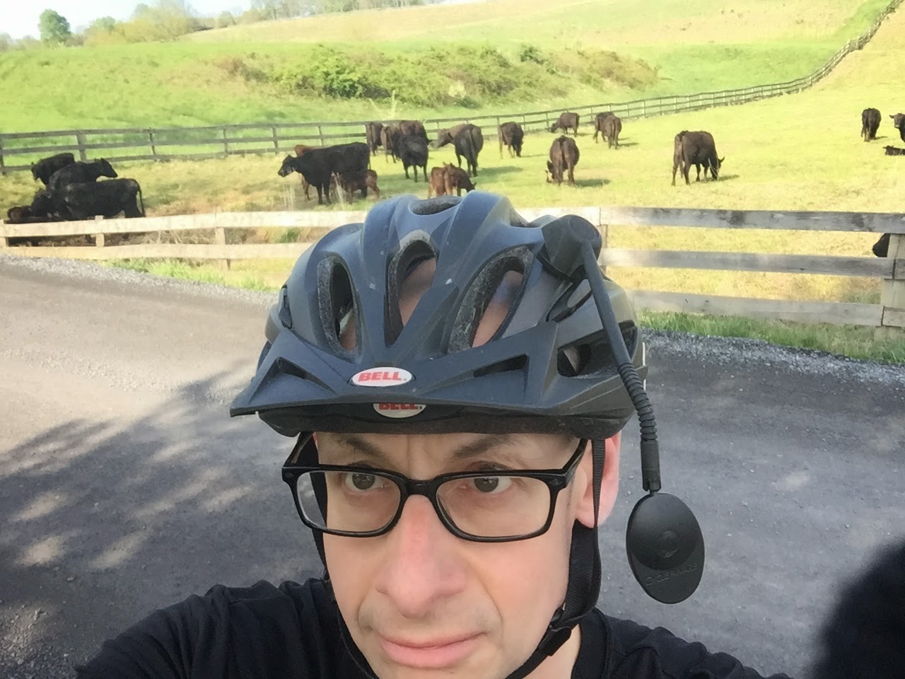
for my second outing involved riding through Seven Corners, a traffic-choked mega-intersection near my house. The good news is that it went without a hitch. In fact, this ride was not very eventful, so I'll summarize it in brief: rode down Roosevelt St. past the cemetery. On the streets I missed my nice, big bar-end mirror, and was using a tiny helmet mirror  instead. I was so busy fiddling with the helmet mirror that I forget to pedal on an uphill and almost toppled over.  Speaking of hills, jeez, the local streets are both really hilly and full of potholes - things you don't notice as much when driving them in a car.

I was a little anxious about having my feet clipped in in traffic. Had to detour to Cherry Street to cross Route 50. Left the bike sitting outside at Meadows Farms and was so paranoid about it getting stolen that I could barely concentrate on my business. I mean, the darn thing cost as much as my first two cars combined (caveat: not an inflation-adjusted number). Rode to Westover, then home. Total distance: 5-6 miles. Verdict: the old beater hybrid bike might be better for this sort of riding.

One more point: if I'm going to do more urban road riding I need to overcome my New Yorker's habit of buying black clothing. My black running pants, black jacket, and black helmet were probably not great for maximizing my visibility on the streets.

Test Ride 3: Experimenting with Gravel

OK, the thing about an adventure bike is that it's supposed to be a Swiss Army knife - able to handle road riding, rough roads, commuting and so on. It was time to put more of these capabilities to the test. I mapped out a nice country ride, adapting (shortening, that is) a route published on MapMyRide by a cyclist named Vincent Ng. I do not know Vincent, but I know someone who rides with him (that's how I stumbled upon his posted routes) which gave me confidence in using his route as a basis. 

Early Sunday morning I drove out to Leesburg, parking my car at Loudon County High School. Based on the number of road rats in perky jerseys clogging Dry Mill Road, Leesburg seems to be a popular cycling destination, but I had the parking lot to myself. I got my gear ready and was soon on my way! I had a printed set of directions (cue sheet) with me, but a combination of my inexperience at this sort of navigation and some out of place road signs meant that I was going to wind up having a somewhat different ride than planned.

Up Catoctin Circle into Fairview Street. Left onto Old Waterford Rd., which soon turned from pavement to hilly, twisty gravel. Whee! Leesburg may be only 35 minutes from home, but it's a different world. This was a real country road, complete with farms, livestock, and lovely rural views. Mixed in with the cows and the farms here and there farmland was being churned up into housing subdivisions. Pavement will surely follow. Sigh. As a total newcomer to gravel riding I'm not ashamed to say I took it slowly - low gears up the hills, riding the brakes back down. The bike was sure-footed throughout; it's the rider who was uncertain. The Gangster has a shorter wheelbase than my other bikes and so felt quite lively throughout the ride, but was still comfortable.
On Old Waterford Road

Old Waterford Road ends in the town of Waterford, which I had not previously heard of. It's a quaint little town with lots of structures from the 1700's and 1800's. Quiet, well-kept. My planned route was to go down the town's Main St., but I made the first of several navigation mistakes and instead headed along High St. into Clarke's Gap Road.

Riding back in New York exposed me to a lot of things, but I never had to worry how to handle courteous drivers - it just never came up. What I experienced today was that about half the drivers who came up behind me as I rode in this area would slow down and pace me for an extended period rather than just passing me, even if the road was otherwise empty. I wasn't sure if there was some signal I should have been giving to tell them that it was OK to pass, so each time this happened I'd just ride on, squeezing as far to the right as I could get, and eventually they'd pass me.

After a while I realized that I had made a wrong turn but decided to continue on, giving myself the opportunity to try out a little road riding. Clarke's Gap Road was a big street but it was still pretty scenic and I enjoyed getting some speed up. At one house a couple of unfenced and unleashed big dogs ran along barking at me, but fortunately they didn't pursue me. I continued on Clark's Gap Road to its intersection with Rt. 9 in the village of Paeonian Springs, another place I'd never heard of. There I turned around and retraced my steps to Waterford.

When I got back to Waterford I knew I should just continue on back to Leesburg. I had gotten in the length of ride I had planned and my knees were beginning to get that weird ache they get when I ride (this is a recurring problem - not related to this particular bike - that I need to solve!). But, I had had a taste o' the gravel and wanted more. I figured out where I had gone wrong in my navigation and when I got back to the intersection in question took the correct turn, heading down Main Street as originally planned. As I mentioned before, Waterford is a quiet little town. There's not much commerce left on Main Street - a general store (closed on Sundays), some artists' studios. All the other buildings served as residences. There is an old mill there and a building with a sign saying "Jail" (I guess from the looks of the place it's not in use as such any more). Of course, there's also a historic marker for some Confederate unit.

I always think of Loudon County as being an affluent right-wing Republican bastion intermingled with rednecks, but I wonder if Waterford is an exception. The most common car I observed in town was the Prius, and the one car I saw with political bumper stickers was all Democratic. Maybe it has to do with town's Quaker origins. In contrast, just a few miles away as I rode past Rogue Hollow Farm on Old Waterford Rd. I noticed that they were flying the Confederate flag. It's possible that news of Lee's surrender hasn't reached these parts yet.

Past town it was back onto gravel on Clover Hill Road. Old Waterford Rd. had been a solid, compacted road whereas this one was loose gravel. The bike still held on fine but it was a little slidey, the only place on the ride I wished for something wider than my 35mm tires. It was a ways up this road that I made my second navigation error - but I swear this one wasn't my fault! I had planned to ride a loop of Clover Hill Rd. into Loyalty Rd.  which winds back into Waterford, but the road signs at one intersection were a little twisted and I headed by mistake down Creek Lane, which soon dead-ended. Since I didn't know at that point what exactly I had done wrong to get me to the dead end, rather than explore further I retraced my steps back into Waterford. I explored for a little bit, riding the streets of the town before taking a stretch, snack and potty break at Waterford School.

Then came the final segment back to Leesburg. Since the outsides of my knees were starting to hurt in earnest I decided to take it as easy as possible. It's amazing how slowly you can go on a bicycle and still stay upright! I also tried to focus on making use of the full pedal stroke, pulling as well as pushing. But I kept going ... finally, on the last long uphill before getting back onto pavement I did need to stop for a second to give my knees a break.

Riding back through Leesburg I continued to take it easy. I think I was riding at about 7 or 8 miles per hour at that point. My knees were hurtin' bad. When I got back to the car I finished the 100 calorie pack of almonds I had started as a snack at Waterford, accompanied by the remainder of the mug of coffee I had left in the car and the rest of my water from my water bottle. My watch stopped during the ride and the MapMyRide app had gone into pause mode, so I don't really have an accurate accounting of time or distance. In fact, when I first got back I thought it was about 40 minutes earlier than it was; It was a little disorienting when I started the car and saw its clock - and realized the true time. Reconstructing my track on Google maps I get about 24.5 miles of riding,  over a time period of somewhere between 2.5 and 3 hours - I think.

My knees and my watch may have been in less than perfect condition at the end of the ride, but the good news is nothing else hurt: my butt wasn't sore from the saddle, and my back and neck were fine despite not being used to the drop bar bike (not to mention the jostling of the rough roads).

The high school parking lot was much more full when I got back. There were a number of signs for the "Free Life Church", which appears to hold services in the school. I'm not sure that's consistent with my concept of separation of church and state.

As I pulled out I felt a nice feeling of contentment, even though I had to deal with a pack of road rat cyclists in colorful outfits on Catoctin Circle riding three abreast, taking up the whole width of the road. Jerks clogging up the roads - this kind of behavior is why, even as I ride more, I will likely continue to grouse about cyclists. That notwithstanding, riding the back roads was a whole lot of fun, and the bike is great. Now, to figure out how to beat this knee pain thing ...


A Tale of Four Jess's

 Jesse is not all that common a name, and so unlike the Toms, Davids, and Bobs of the world I don't run into much name confusion. So it ...