Thursday, September 19, 2024

Apostle Islands: Gordon Lightfoot Warned Us

This entry is part of my write-up of a September 2024 trip to The Apostle Islands. The story begins here.

Thursday 9/5

Thursday morning we drove the roughly 20 minutes to our launch point at Little Sand Bay in The Apostle Islands National Lakeshore. Upon our arrival we were met by Ranger Angel (it makes sense that the Apostles have a guardian Angel, right?), who directed us as to where to launch, checked our permits, gave us useful information about the weather, and told us how to describe our location ifwe needed to call 911 (!). She also gave us a once-over and declared that we appeared to be "shipshape". It is not her responsibility to evaluate people's ability to paddle in the open waters of Lake Superior, but by her own admission if she detects that people don't have the appropriate skills or preparation, she'll gently steer them to safer courses of action.  

Loading the kayaks at Little Sand Bay

Many people are familiar with Gordon Lightfoot's song The Wreck of the Edmund Fitzgerald, about how the waters of Lake Superior ("the big lake they call Gitche Gumee") proved too much for a 700 ft., 14,000 gross ton ship. Folks contemplating a trip to the Apostles can also read the part on the official web site where it says that the lake can become "extremely hazardous when weather conditions become unfavorable". Or maybe they will have read John Frank's excellent book in which he states that "the big lake can replace a peaceful, calm sunset on one evening with a life threatening experience the next day." Well, all I can say is that ample warnings were available.

At the time we arrived at our launch point conditions were calm. The wind and waves had picked up a bit by the time we packed the boats, but it was nothing we couldn't handle - maybe 1 ft. waves. There was no extreme weather in the forecast, and Ranger Angel hadn't said anything about particularly rough conditions that day. As we paddled north from Little Sand Bay and rounded Point Detour (the northernmost mainland point in Wisconsin, BTW), things got yet choppier, and soon we were the proverbial frogs being boiled. Things just kept getting a little worse, and we dealt with it, and then a little worse, and we dealt with it, until it got to the point where we found ourselves getting hit by five foot waves coming off the lake from our left.

Thursday's track

How tall is a five foot wave? This is not a trick question - it's five feet peak to trough. When you're sitting in a kayak your head is maybe three feet above the water, and so an alternative answer to "How tall is a five foot wave?" is "two feet above your head". Tall enough that as I was paddling next to Tall Tom, suddenly I'd have to crane my neck and look up to see him, then as the wave moved between us he'd disappear, then when the wave would pick me up I'd have to look down to see him.

Fortunately, for the most part the waves were long period swells - that is to say, like big long sine waves which kept picking us up and putting us down, picking us up and putting us down, which is much better than if five foot waves had been breaking over us, in which case we could have been in real trouble. Nonetheless, it became hard to make progress or even stay on course, particularly with since our kayaks were heavily loaded with a week's worth of gear and food. Plus, every once in a while a wave would crest as it went by, and that release of energy would take a stab at tipping the kayak over, or leave you hanging in the air for an instant like Wile E. Coyote when he steps off a cliff, before you'd plop back down onto the water. Paddling started to require constant vigilance, always being prepared for the next wave that was coming, and placing paddle strokes appropriately.

Interestingly, I didn't feel panicky - in fact, I've experienced waves on the Chesapeake which, while smaller, seemed much more determined to capsize me. Maybe it was the long period of the waves, maybe it was extra stability from the fully loaded kayaks, but I rarely felt like I was in danger of tipping over, even in waves which made me exclaim out loud when I saw them coming at me. To tell you the truth, I was more worried about heart attack from exertion than about capsizing, but I kept checking in with myself and never felt my heart pounding - I was OK. As we fought our way forward we knew we would have a chance to take a break when we got to Raspberry Island, about five miles into our twelve mile trip. By the time we got into the thick of it turning around wouldn't have been any shorter or safer than continuing, so we plugged on, working really hard to keep forward momentum going. This went on for what seemed like a really long time.

Finally, as we started to get into the lee of Raspberry Island we got some shelter from the wind and the water conditions began to settle down. We stumbled onto the beach, which happily was on the protected side of the island, and all let out a collective "What the h*ck did we just go through?", as we had all just made it through the roughest conditions of our paddling lives. But fortunately, at this point we were safe. Camping isn't officially allowed on Raspberry Island, but we knew that if we needed to we could make emergency camp there until conditions calmed down. Raspberry also has a lighthouse and is visited by tour boats, so we were within range of "rescue". The funny thing is that as we had fought our way through the waves I, usually the most cautious of the group, figured that everyone else had been having a grand old time riding the rough stuff. When we got to the beach it turned out, though, that everyone else was at least as frazzled as I was. I just wish I had hooked up my GoPro - that would have been some great video!

We took a good long break to eat lunch and collect ourselves. Rob even got out a new toy he had picked up at one of the outdoor stores - a floating thermometer in the shape of a rubber duck (BTW, water temp was about 65 degrees). We decided we'd walk the several hundred yards down the beach to a point where we could see the rest of our route to our destination on Manitou Island, and then make a decision as to what to do. Fortunately, the waters between Raspberry and Manitou Islands appeared much calmer. Once you get east of Raspberry you get some protection from other islands farther out, and so you're not fully exposed to the fetch of the full lake. We decided to continue on.

Rob walks his duck at Raspberry Island - quack, quack, quack!

Once we relaunched we realized anew how tired we were from fighting the waves. As I paddled, my arms hurt, my abs hurt, and my whole core hurt, and everyone else was feeling the same way. As we had been preparing to launch someone had struck up a conversation with me, saying the scale of the islands was tricky. You could be paddling towards an island that seemed fairly close by, and you'd paddle and paddle, and yet the island never seemed to get any closer - more foreshadowing! This certainly seemed to be the case as we huffed and puffed to keep our kayaks moving forward. It also didn't help that we falsely had in our heads that we had only five more miles to go, when the distance was actually closer to seven. It took us 2.5 hours to go the first 5 miles, and then another 3.5-4 to go the next 7. That's pretty slow, and is attributable to a combination of lake conditions, exhaustion, and paddling loaded boats.

Finally, we made it to Manitou Island, where we were greeted by a rainbow, as if some great lake spirit was saying, "your trial is over!" Even with coordinates in hand and the efforts of master navigator Béla it took us a little poking around to find our campsite. One area for improvement is that the Park Service really needs to mark the campsites so they can be more easily seen from the water. This campsite had a tiny sign, and the one to which we moved a few days later had no sign at all. We came ashore to find a lovely campsite (just as promised by the book), with plenty of room for all of us, a metal "bear locker" where we could store our food - so we didn't have to go through the hassle of hanging our food, which was great. I was cold and wet and shivering, so I pulled on my new no-brand neoprene jacket ($39 well spent dollars on Amazon, half the price of the name-brand NRS jacket) and set to work getting my tent up and getting unpacked so I could change into dry clothes. Tom somehow had it together enough to prepare us a delicious dinner of sloppy joes, but when it started to rain we all retired to our tents and turned in early for the night. I slept almost nine hours, which is unusually long for me, particularly since I usually toss and turn on the first night of a camping trip. Ironically, by the time we went to bed the lake was dead calm - another thing we had read which turned out to be true was that the lake typically starts out calm in the morning, gets more windy and wavy mid-day, then calms down late afternoon into the evening.

Manitou Island off in the distance - and a rainbow

Friday 9/6
One thing we do for safety when we do these trips is to bring cell phones from as many major carriers as we can. At our campsite on Manitou Island we had no connectivity on Verizon or AT&T, but Tom's T-Mobile hotspot sniffed out a tiny bit of signal (I suspect that, being a special purpose device, it has a larger antenna and possibly better signal processing than a cell phone), which had allowed us to get messages home saying that we were safe and sound. Rob and Tom take care of a lot of campcraft - setting up the kitchen, filtering water, and so on, and so I was happy to take on the job of group weatherman. Unfortunately, while we could send and receive texts we had little to no data connectivity, so I got a weather forecast the old-fashioned analog way via our marine VHF radios. It turned out that there was a Small Craft Advisory in effect for the day, indicating that winds could reach dangerous levels for small boats. Having experienced what the lake could do without a Small Craft Advisory in effect, and being a little bit sore from the previous day's adventure, we were perfectly happy to spend the day ashore. We got our camp better organized, put up our rain tarp, and chatted about our experience. I must say, we had done well individually and as a group. You always want to have skills for conditions worse than what you expect to encounter in case, as we had experienced, the situation gets unexpectedly challenging. All of us had maintained good control of our kayaks, had for the most part stayed together as a group, and had kept an eye on each other.  We talked through what we would have done if one of us had wound up in the water (note, we agreed that two of us would have executed a rafted rescue while the third patrolled, ready for contingencies such as chasing down a lost paddle).  I honestly believe we could have pulled off such a rescue, but it would have been exhausting for rescuers and victim alike. Now, if more than one of us had wound up in the water, that would have been tough.

In the afternoon we hiked down to the Historic Manitou Fish Camp, a ramshackle 1930's-era fishing camp preserved by the Park Service. Unfortunately, many of the buildings were locked up (the site is currently officially closed for renovation), but we got to visit the outdoor structures and peek inside the buildings. Also, being on the side of the island which faced the mainland, we got a little bit better cell signal, and so I set to work downloading weather forecasts. The walk to the fishing camp from our campsite was about 1.8 miles. Rob and Tom headed straight back, while the ever-energetic Béla and I explored a side trail to a scenic overlook, which turned out to be just another beach on the island - not really worth the detour. All told, Béla and I walked about four and a half miles. 

Hiking on Manitou Island

Manitou Fish Camp

Checking out the smoker at the fish camp

Rob prepares lovely multi-course dinners, and on Friday we had an appetizer of hummus and crackers, followed by turkey sausage jambalaya, with toffee and spiced dried fruit for dessert. We were treated to a beautiful sunset with golden light at our west-facing campsite, followed by an amazingly clear night full of stars. However, the weather still had some monkey wrenches to throw into our plans. Our intent had been to camp at Manitou for three nights, but while the forecast called for calm conditions for Saturday, Sunday's forecast included another Small Craft Advisory. We really didn't want to do another long paddle in high winds with loaded boats, so we decided to break camp and move to our second campsite on Saturday, a day early. Fortunately, I had foreseen this possibility and had overlapped our campsite reservations. So, we enjoyed our lovely evening on Manitou Island, then snuggled into our sleeping bags early again (another monkey wrench - frost advisory in effect!), knowing we'd be getting up early to break camp and reposition.


Golden sunset light at our campsite

Checking the forecast over breakfast
Béla doing the dishes


Example of one of the weather forecast pages I was able to use when we had connectivity

Continue to the next part of the trip.

Tuesday, September 17, 2024

No Man is an Island (except sometimes) – The Trip to the Apostles

Monday 9/2

After packing the car to the accompaniment of a pretty sunset on Sunday (a positive portent), Tall Tom and I departed for The Apostle Islands on the afternoon of Labor Day. Rob and Béla were a few hours ahead of us. There’s not much to say about driving the Interstates – the miles slowly ticked by as we headed through Pennsylvania and into Ohio. I will mention that I was surprised to encounter diversity I hadn't expected at a highway rest stop outside of Cleveland. I noticed an obviously Orthodox Jewish guy gassing up a minivan, and spotted the rest of his family inside the rest area. In a sort of balance, when we came back to the car there were two Muslim guys prostrate on the grass strip next to the parking area doing their evening prayers. Being a dog owner, Tall Tom pointed out that the grass right next to the parking spots at a highway rest stop might not be the most sanitary place to stick your face, but oh, well – the things we do for our faith. While the two of us ate dinner we noticed the adjacent table was occupied by a large Hispanic family, fully decked out in MAGA gear. Even the kids had their red hats and Trump shirts on. I pictured Ohio as being a bunch of bland, white bread people – I guess I was wrong.

Pretty sunset while loading the car

We had intended to go only as far as roughly Cleveland (if even that far) on Monday, but once Rob and Béla texted that they had made it all the way to Ann Arbor, we decided we would make it there too. While they had arrived in time to have a nice dinner and brewpub visit, Tom and I got in about 9 PM, just in time to settle in and hit the hay. Our hotel was a eerily deserted Wyndham Conference Center, and when the four of us met up for breakfast on Tuesday we had the place to ourselves. At about 9 AM we set off together, having switched teams for the day – I had Béla in my car, while Rob and Tom rode together.

Tuesday 9/3

There are two routes to The Apostle Islands: one across the bottom of the Great Lakes, and the other up through Michigan, including crossing the Upper Peninsula (“UP”). Both routes are about the same length, and my traveling companions were good enough to agree to take the “UP” route, which would take us through Escanaba, MI, home to Aronson Island. A long time ago I typed “Aronson” into Google Maps just to see what would come up, and along with a lot of accounting firms and other professional practices, up popped Aronson Island. It’s been a “bucket list” destination for me ever since, and so we made Escanaba our planned second night stopping place. 

Along the way to Escanaba we did have some fun, including stopping at Northwoods Outfitters, a giant outdoors store focused mostly on hunting and fishing, but with some stuff of interest to our style of outdoorsiness. We stopped for lunch at a restaurant called Darrow’s in Mackinaw City just before the bridge to the “UP”. Darrow’s looked like it could have been generated by AI from the prompt “Midwestern Diner”. Big display case of pies. Lots of people in plaid and other L.L. Bean-looking clothes. Significantly high average BMI (maybe from all that pie). The menu highlighted fresh lake whitefish, a Great Lakes fish which is apparently the same fish used in the kosher deli whitefish salads of my youth, and so I ordered a blackened whitefish sandwich. It was very fresh and delicious – firm, and flavorful but not fishy. For dessert we all split a single piece of their pecan pie.

We had made reservations at one of Escanaba’s two hotels (while the town is neat and tidy I sense it’s not a big tourist destination), choosing the one within walking distance of America’s best island. When the Hotel Luddington opened in 1864, it was (per a historical marker) “the largest and only hotel in the city having baths, steam heat and electric call bells - $2.00 per day”. Today, there are no longer electric call bells and the price has gone up somewhat, but the place seems otherwise unchanged since its Civil War era heyday, and it would be a great setting for a Scooby Doo mystery. Big, old, and creaky. Our rooms turned out to be suites – mine had a bedroom, living room, full kitchen, and a strange empty walk-in closety sort of space, and all-told was at least as big as my first apartment in New York. The furnishings were sort of yard sale/antique shop caliber, and my suite had paintings where you felt the eyes should be following you as you walked around. In addition to our group, the only other guests we saw were a large and friendly group of motorcycle tourists.

Main Street, Escanaba, at sunset

Home at last!

I drove 900 miles for this picture!

After a day of sitting, the four of us were eager to move around a little and so we walked the length of the town’s commercial strip. Like many so many American towns, Escanaba has a quaint but failing downtown. There are a handful of shops, the most thriving of which seemed to be the cannabis dispensary. Sadly, it was not called Escannabis, which would be what I would name my business were I to open a cannabis dispensary there. At dinner we ran into the motorcyclists again, which was not too surprising since there were only two open restaurants in town. After a surprisingly good meal, we walked over and made our first visit to Aronson Island, where we staged a photo shoot in front of the island’s sign.

The House of Luddington


House of Luddington decor

The House of Luddington’s past guests include Thomas Edison, John Phillip Sousa, The Harlem Globetrotters, and Johnny Cash. Surprisingly, we were not visited by any of their ghosts during the night (being visited by the ghost of Johnny Cash would have been super cool!!), and in the morning after a quick cup of coffee we loaded up our stuff and headed back to Aronson Island – this time by car – where I was thrilled to find more signs, each unique. My original bucket list hope had been to actually launch my kayak from my island, but with a full day’s driving ahead, none of us really felt like pulling the boats down and getting into full paddle rattle just to say we had done it (though adding a second Great Lake to our trip’s paddling would have been cool). Instead, we satisfied ourselves with exploring by car and on foot, including visiting the island’s pretty beach, which faces Little Bay du Noc on Lake Michigan. We took lots more pictures.


Aronson Island signs

Aronson Island Beach

All good things must come to an end, and eventually we departed Aronson Island, bound for our final destination of Bayfield, Wisconsin. Escanaba didn’t really offer anything in the way of breakfast (I had hoped to try the signature Swedish pancakes at the Swedish Pantry downtown, but alas, they were closed for renovations). We set off with empty stomachs, figuring we’d grab something along the road; however, once you leave Escanaba, there isn’t much of anything along the road through the UP, and we drove about 75 miles before we came upon a tiny strip mall which contained a Subway and, interestingly, a rather hip coffee bar called “Buddha Bean”. I got an egg sandwich at Subway and a decaf Americano at Buddha Bean. The barista was apparently new, and while she pulled the espresso shots without issue, she added tap water rather than hot water (an Americano is several espresso shots diluted with hot water down to American coffee strength), leaving me with a lukewarm coffee. Worst coffee I’ve ever had in Crystal Falls, MI! I'm giving them only one star! I should have gone back and had them remake it, but we were eager to resume moving.

Escanaba to Bayfield was a relatively short 4 ½ hours, which was nice. As we approached Bayfield we of course stopped at another outdoors store, and I noticed the rather nice looking StageNorth Arts Center. I guess the human urge to create art is strong, even in the remote Chequamegon Bay area.

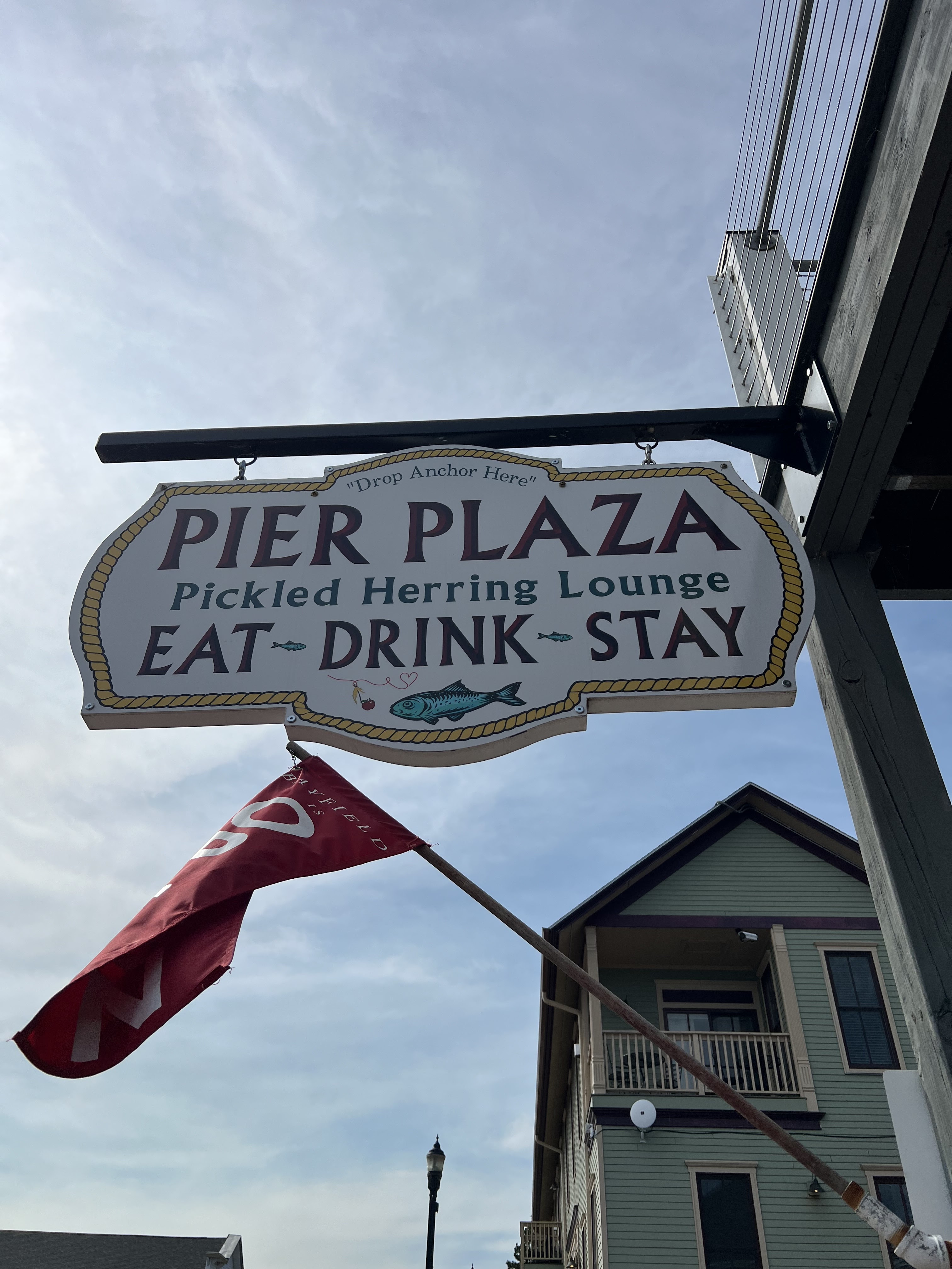
Our first stop in Bayfield (because we stumbled upon it) was the Maritime Museum, where we learned about the maritime history, and lots of shipwrecks – foreshadowing! – of Lake Superior. Tall Tom had reserved an AirBnB for us, and after checking in we had a light lunch in town. I could tell we were in Wisconsin from the fact that my "salad" was 85% cheese and 15% salad greens. We spent the rest of the day on the typical fussing we do the night before launch – buying fresh food items, and packing, re-packing, and re-re-packing gear. We did have a very nice dinner at The Pickled Herring, a restaurant with a deck overlooking the lake. Rob, who loves all manner of fish and fish parts, ordered the whitefish livers, which sadly, weren’t as exceptional as the fish itself. We retired early to get a good night’s sleep before launching.

Shipwreck display at the Maritime Museum in Bayfield


Surprisingly good map of The Apostles from 1671


Rob ordered the whitefish livers at The Pickled Herring

Continue to the next part of the trip.

Wednesday, August 28, 2024

A quick summary of California

We made our annual visit to Ted in California last week. Let me start with a story about not judging people. On the flight home I developed one of my instant dislikes (some might say this is my default reaction to people - but I'm not quite that bad) for the guy in the seat in front of me. This guy was probably about 6' 3", and was carrying a gut large enough that it should have had its own seat. He was wearing an Arlington County Fire Department t-shirt, though honestly, I think the only way this guy could have contributed to putting out a fire was by smothering it with his belly. 

Why did I take a disliking to him? First, every time he sat down in his seat he caused the seat, and with it my tray table, to rock at the level of severe turbulence. Second, when it was time to "de-plane", apparently he had a bag in the overhead bin two rows back and he just shoved his way through everyone to get back to his bag - including nearly tackling me - without so much as an "excuse me". 

Anyway, after the flight we're all at the baggage claim. I was standing right where the conveyor belt burps up bags onto the baggage carousel. My bag came out right after another, and so was stacked above the preceding bag, which made it impossible for me to grab, particularly from my position at the end of the carousel. Fortunately, another passenger who saw me struggling reached out and helped me wrestle my bag free. What a good Samaritan. And yup, it was gut man from the seat in front of me. I am so ashamed of my misanthropic tendencies.

Anyway, California was, as always, warm, sunny, expensive, and required a lot of driving.

Another anecdote: I drink only decaf coffee, and the only decaf my son had in the house was the remnants of the bag I had bought when we visited a year ago. So, when upon arrival we went to the supermarket to buy a few things I started to pick up a bag of coffee but he assured me that we could get much, much better coffee at this cool coffee place in Palo Alto. Sure enough, the Blue Bottle Coffee in Palo Alto is very cool - co-located with a co-working space in a converted old movie theater with Moorish architecture. But my bag of coffee rang up for $23. I noted today that the very same Blue Bottle coffee was on sale at Target for $13 per bag, which is still more than I usually pay for coffee, but within the bounds of reason. It just goes to show you, Silicon Valley people have too much money and not enough sense - no matter what the price, if it's cool (or whatever word the kids use today to mean "cool"), there's no limit to what they'll pay for it.

Moorish courtyard at the Blue Bottle in Palo Alto

Anyway, we did a lot of fun activities while we were there:

- On Tuesday we arrived, got ramen at the fabulous Ramen Nagi, got ice cream at Salt and Straw, which has "I'll pay through the nose because it's cool" Silicon-Valley-cool flavors like Smoked Mac and Cheese, and Pear and Blue Cheese (I've got to admit, their ice cream is really good). We also took Ted's lizard Sierra for a walk in her special bubble backpack.

Walking Sierra the lizard

- On Wednesday Valerie and I tried pickleball. I will mention that in Arlington, pickleball courts are a rare and highly utilized commodity; they do not go empty, even for a minute. At Stanford, however, Ted was easily able to book us court time. Valerie actually took a fall running for a ball and wound up sitting a bunch of the session out. I showed myself to be not too embarrassing for a total novice. After recovering from the exertion, in the evening we sat on the sidelines and watched Ted play ultimate Frisbee.

Pickleball with Ted

- Thursday I started my day with a run (cool mornings! no humidity!), then we went out to Pleasanton California, a not-surprisingly pleasant little town with cute shops. Ted got us to eat at Zachary's, a Chicago-style pizza place. Let me just say, Chicago-style goopy cheesy casserole is not pizza (Jon Stewart agrees with me on this one), but it was still good. Ted and I also took time to find an underground geocache while Valerie (the most sane of us, at least when it comes to crawling through tunnels for fun) waited nearby. And, we got soft-serve at some famous place where again, people line up to get ice cream. Fortunately, mid-day on a weekday there was no line, which was good, because the ice cream wasn't anything special. This was the second of a total of three ice cream desserts I got during the week - which is insane compared with my normal eating habits, but oh, well.

As if pickleball and Pleasanton weren't enough (and sufficiently alliterative), that evening Ted and his housemates hosted a paint night. An art teacher Frisbee friend of Ted's led us all through painting a night-time scene. To feed and lubricate the attendees we supplied a weird selection of stuff from Total Wine (Sunny-D coolers, Manischevitz) and got Indian pizza, a weird cross-breed consisting of pizza with Indian toppings.

My run took me past Levi's Stadium, site of next year's Superbowl

Awaiting our cheesy, gooey casserole

Geocaching

Paint Night results

- Friday Ted and I started the day with an eBike ride on local trails, then the three of us went out for coffee and pastries and yet another impossibly hip Silicon Valley place (The Midwife and the Baker). We played another round of pickleball on again shockingly uncrowded public courts in Mountain View, and in the evening Ted treated us to homemade hot pot. I liked it; Valerie was lukewarm on the hot pot.

Bike trail

Cyclist selfie

Cool pastries

Hot pot

There's a lot of property crime in the area - note two signs warning you about car break-ins.

- Saturday and Sunday we made a little overnight trip up north. Saturday, after stopping in Berkeley to have coffee at the very first Peet's Coffee (and eating lunch at an outdoor table while a mentally ill man screamed at us through the whole meal - typical Berkeley, apparently), we headed north for the Cotati Accordion Festival, an event which has been on my bucket list since I discovered its existence. Multiple stages of accordion music! A dedicated polka tent! Accordion merch! It was almost too good to be true.

At the original Peet's Coffee

At the accordion festival
Zydeco dancing

Open air accordion market. Perhaps this is the kind of thing Donald Trump means
when he says San Francisco is "not livable"

After a Mexican dinner we retired to a hotel in Petaluma, an unusually cool Hampton Inn housed in a vintage silk mill building.

- Sunday we got up and made the twisty, winding drive (Valerie wasn't happy) to Muir Woods, where we marveled at the giant redwoods. On the way back to Ted's place he insisted on taking us to eat at a burrito joint in the Mission District. He felt that the Mexican place where we had eaten in Cotati wasn't real Mexican and he wanted us to experience the genuine article (non-Latino Virginian transplant Ted feeling that he is an arbiter of true Mexican food reminded me of Street Eats). Getting to this place and then waiting in their foolishly long line took a bunch of time, and the burrito wasn't really anything special. I must admit that my opinion may be influenced by the fact that they had given me the wrong burrito, and I couldn't go back and fix the order since we had gotten the food to go. Where did we eat our burrites? Well, there was no nearby park or anything so we wound up getting sodas at a McDonald's - a branch of the chain which, like everything in the immediate area, was dominated by the mentally ill and unhoused! - and eating our burritos on the sly there.

At Muir Woods

Muir Woods

Muir Woods

Some big trees!

- Then, Monday morning we headed home on the flight with fireman big-gut, about whom I've already written.

A fun and action-packed visit. Always great to spend time with Ted!


Wednesday, June 19, 2024

Not quite according to plan

 I went to paddle at Mason Neck the other day not just because it's one of my favorite local places to paddle, but with several specific goals in mind:

1. Check on the geocache I had hidden on tiny Conrad Island, and do maintenance as necessary (e.g., replace the logbook).

2. Paddle at least 10 miles

3. Get some nice wildlife photos

Well, #1 had an unexpected outcome, I didn't achieve #2, and I kinda did OK with #3, but could have done better if things had gone according to plan.

While unloading my boat I chatted with a young guy in a Virginia State Parks polo shirt who was hanging around the launch. He told me that he was the kayak rental attendant, that the park had decided that it was too disruptive to haul someone over from the Visitor Center every time people wanted to rent kayaks and so had decided to hire someone to staff the kayak rental. My first thought was that the park must have better things it could spend its money on than this position - particularly staffing it on a weekday morning. It was Monday 9 AM and there wasn't exactly a big crowd of people waiting to check out kayaks. The second thing I thought was that weekday kayak attendant must be an intensely boring job, since there's essentially nothing to do.

After unloading my gear I moved my car to the parking lot, and by the time I got back to the launch area the attendant was gone. He also wasn't there when I paddled by later, nor was he there when I landed at the end of my outing. Maybe the park service hired him to work just Monday 9-10 AM. Or maybe I imagined him.

Anyway, my plan was to paddle across the bay to Conrad Island to check on the geocache, then head out around the bend into the river. Conrad Island is a wisp of an island situated on the opposite side of Belmont Bay, next to the boat channel which leads into the marinas along the Occoquan River. It's so small and low-lying that the boat wakes and waves have eroded it into multiple pieces, the biggest of which isn't more than a few hundred feet across. Back in 2008 I hid a geocache on the largest fragment of island, and people have generally like the adventure of boating across to the island to find the cache. However, as I approached this time I spotted something new: giant "No Trespassing" signs located all around the island. It's not clear to me who owns and manages the island, but clearly they don't want anyone to come there! Rather than update my geocache, when I got home I logged on and marked it as Archived (retired).

I think this means Keep Out

From there I headed southeast through Belmont Bay, heading for Occoquan Bay with the goal of heading out to the river. As I paddled it quickly became apparent that the wind was blowing much more strongly than had been forecast, maybe 15-20 MPH. The wind was whipping up the water too - nothing dangerous, but 1 to 1 1/2 foot waves, occasionally breaking, and sometimes rolling over the deck of my kayak. As I paddled I debated the wisdom of heading out into more open waters in these conditions, and when I got to the point where I could see out into Occoquan Bay, I decided that maybe going out there wasn't going to be a good idea. I mean, I could have handled the conditions but it wouldn't have been much fun, and you always have to think about what would happen if conditions deteriorated further. I turned around and decided to head up Kane's Creek instead. The creek is the most protected area around Mason Neck. It's popular with beginner paddlers (like folks who rent from the mystery kayak attendant) and is quite pretty. I had brought my nice camera with me, and was kind of disappointed that I wasn't going to get out to the river, which is where there's the greatest chance of seeing eagles, but I figured that even if I made it out there it was too rough for me to be able to pull out my camera and take photographs. Safety first.

A pretty spot on the water

As I headed towards the creek I took a quick break for water and a snack, and noticed that I was slowly drifting towards a blue heron. Herons are really skittish and it's hard to get close to them, but I figured that my drift rate might be slow enough that it wouldn't alarm the bird as I approached - and sure enough, I got close enough for some nice photos. Also, as I paddled eagles started swooping around like crazy - there were four or five hanging around together. Unfortunately, there was no way I was going to be able to grab my camera and catch them in flight. I had to "make do" with the joy of just seeing them.

Pretty good heron photo

I entered Kane's Creek and paddled a little ways up but quickly ran into hydrilla. Hydrilla is an invasive plant which chokes waterways, creating a dense mat of plant life under the surface so thick that you can't even get a paddle through it. Some years it doesn't seem to bloom at all, while other times it can make the areas where it grows impassible. I've never seen it so thick so early in the season before - but once I got to where I couldn't go on without crunching through the vegetation I turned around.

Showing the little birds some photo love too

While I was paddling back towards Mason Neck I saw some eagles again and detoured towards them to see if I could catch photos of any of them when they landed in the trees (eagles typically fly for a bit then hang out at the tops of the trees). I had a little bit of success in that I did get some pictures of two eagles in the trees, but nothing spectacular. I need a longer lens.

Eagle photo

Another eagle

When I got back to Mason Neck I discovered that I had only paddled 6.35 miles - well short of my ten mile goal. However, I had a varied, interesting experience and got the unexpected bonus of getting a little rough water practice in. The weather had been beautiful; it was a lovely morning out on the water.

Butterfly on the beach

Water scene from onshore

-----
Addendum: another reason I'm sad to see my geocache go is that I loved the name I had given it. The cache was on Conrad Island, which is home to lots of birds. It's a great place for birding, so I named the geocache "Bye Bye Birding", which is a play on "Bye Bye Birdie", a 1960 musical the main character of which is named Conrad Birdie. Get it? Conrad Birdie, Conrad Island full of birds? "Bye Bye", because the island is disappearing? Birdie vs. birding? Dear reader, if you are not currently overwhelmed with laughter from the cleverness of my geocache name you should see a doctor about your atrophied sense of humor. 

Bike Refurbishment

Would you like to read a bunch of nerdy stuff about how I've been tinkering with my bicycles? Of course you would. I have two bicycles (...